SeismicPortal
 is the European Infrastructure
 for seismological products in :
is the European Infrastructure 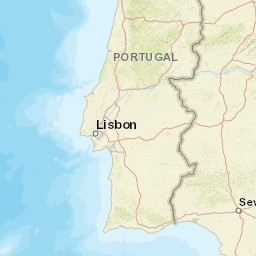


| Datetime (UTC) rmsOT_error |
Lat Smajor |
Lon Sminor |
D. (Km) AzErr |
Ndef mdist |
Nsta Mdist |
Gap | Mag1 (N) Err |
Mag2 (N) Err |
Mag3 (N) Err |
Author Quality |
|---|---|---|---|---|---|---|---|---|---|---|
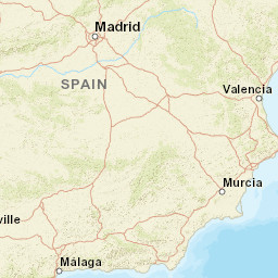
| 2025-07-03T15:54:02.83Z 0.62+/- 1.25 |
36.3228 9.6 |
-4.6493 6.1 |
94.2 1788.8 |
16 0.261 |
8 3.225 |
256.1 | mb 1.8 (7) 0.4 |
() |
() |
IGN m i ke |
| Sta | Dist | EvAz | Phase | Datetime | Tres | Azim | AzRes | Slow | SRes | Def | SNR | Amp | Per | Mag1 | Mag2 |
|---|---|---|---|---|---|---|---|---|---|---|---|---|---|---|---|
| EMIJ | 0.261 | 337.62 | P | 2025-07-03T15:54:15.988Z | -0.1 | ||||||||||
| EMIJ | 0.261 | 337.62 | S | 2025-07-03T15:54:26.59Z | 0.1 | ||||||||||
| ELGU | 0.986 | 56.24 | P | 2025-07-03T15:54:21.151Z | -1 | 1.8 | 1.209e-7 | mb 1.2 | |||||||
| ELGU | 0.986 | 56.24 | S | 2025-07-03T15:54:35.314Z | -1.1 | ||||||||||
| EADA | 1.842 | 1.77 | P | 2025-07-03T15:54:32.734Z | 0.2 | 1.5 | 8.12e-8 | mb 1.6 | |||||||
| EADA | 1.842 | 1.77 | S | 2025-07-03T15:54:54.22Z | -0.4 | ||||||||||
| ECAB | 1.854 | 340.88 | P | 2025-07-03T15:54:32.932Z | 0.3 | 1.7 | 1.114e-7 | mb 1.7 | |||||||
| ECAB | 1.854 | 340.88 | S | 2025-07-03T15:54:54.121Z | -0.6 | ||||||||||
| EQES | 1.943 | 40.04 | P | 2025-07-03T15:54:33.541Z | -0.3 | 1.4 | 8.99e-8 | mb 1.7 | |||||||
| EQES | 1.943 | 40.04 | S | 2025-07-03T15:54:57.589Z | 0.9 | ||||||||||
| EMIN | 2.168 | 312.3 | P | 2025-07-03T15:54:37.158Z | 0.4 | 1.2 | 9.790000000000001e-8 | mb 1.9 | |||||||
| EMIN | 2.168 | 312.3 | S | 2025-07-03T15:55:01.21Z | -0.6 | ||||||||||
| EBAD | 3.07 | 322.98 | P | 2025-07-03T15:54:48.798Z | 0.1 | ||||||||||
| EBAD | 3.07 | 322.98 | S | 2025-07-03T15:55:23.133Z | 0.6 | ||||||||||
| PAB | 3.225 | 4.12 | P | 2025-07-03T15:54:50.255Z | -0.5 | 1.5 | 7.42e-8 | mb 2.3 | |||||||
| PAB | 3.225 | 4.12 | S | 2025-07-03T15:55:25.731Z | -0.4 | ||||||||||
| Sta | Dist | EvAz | Phase | Datetime | Tres | Azim | AzRes | Slow | SRes | Def | SNR | Amp | Per | Mag1 | Mag2 |
| Centroid | Nodal Plan 1 | Nodal Plan 2 | Tensor | Moment Inf. | |||||||||||||||||
|---|---|---|---|---|---|---|---|---|---|---|---|---|---|---|---|---|---|---|---|---|---|
| Auth | Datetime | Lat | Lon | Depth | Mw | Strike | Dip | Rake | Strike | Dip | Rake | Mrr | Mtt | Mpp | Mrt | Mrp | Mtp | %DC | %ISO | %CLVD | |
| Auth | Datetime UTC | lat | lon | Depth | Mw | Strike | Dip | Rake | Strike | Dip | Rake | Mrr | Mtt | Mpp | Mrt | Mrp | Mtp | %DC | %ISO | %CLVD | |

