SeismicPortal
 is the European Infrastructure
 for seismological products in :
is the European Infrastructure 


| Datetime (UTC) rmsOT_error |
Lat Smajor |
Lon Sminor |
D. (Km) AzErr |
Ndef mdist |
Nsta Mdist |
Gap | Mag1 (N) Err |
Mag2 (N) Err |
Mag3 (N) Err |
Author Quality |
|---|---|---|---|---|---|---|---|---|---|---|
| 2025-07-01T15:20:43.0Z 0.75+/- |
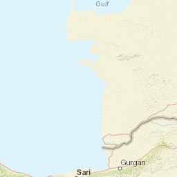
38.3189 |
38.1658 |
7 |
21 0.193 |
11 1.074 |
104.3 | ml 1.2 () |
() |
() |
AFAD m i ke |
| Sta | Dist | EvAz | Phase | Datetime | Tres | Azim | AzRes | Slow | SRes | Def | SNR | Amp | Per | Mag1 | Mag2 |
|---|---|---|---|---|---|---|---|---|---|---|---|---|---|---|---|
| AKCD | 0.193 | 263.28 | P | 2025-07-01T15:20:46.96Z | -0.11 | ||||||||||
| MAYA | 0.204 | 88.12 | P | 2025-07-01T15:20:47.27Z | -0.23 | ||||||||||
| MAYA | 0.204 | 88.12 | S | 2025-07-01T15:20:50.53Z | 0.02 | ||||||||||
| MTOP | 0.33 | 228.25 | P | 2025-07-01T15:20:45.54Z | -4.1 | ||||||||||
| MTOP | 0.33 | 228.25 | S | 2025-07-01T15:20:52.56Z | -1.69 | ||||||||||
| MYES | 0.393 | 151.4 | P | 2025-07-01T15:20:51.34Z | 0.4 | ||||||||||
| MYES | 0.393 | 151.4 | S | 2025-07-01T15:20:55.81Z | -0.72 | ||||||||||
| MKAM | 0.406 | 89.32 | P | 2025-07-01T15:20:51.85Z | 0.48 | ||||||||||
| MKAM | 0.406 | 89.32 | S | 2025-07-01T15:20:56.53Z | -0.75 | ||||||||||
| NARI | 0.64 | 132.57 | P | 2025-07-01T15:20:59.99Z | 4.27 | ||||||||||
| NARI | 0.64 | 132.57 | S | 2025-07-01T15:21:05.48Z | 0.59 | ||||||||||
| ELZG | 0.667 | 74.2 | P | 2025-07-01T15:20:56.73Z | 0.32 | ||||||||||
| ELZG | 0.667 | 74.2 | S | 2025-07-01T15:21:05.78Z | -0.32 | ||||||||||
| ELBS | 0.812 | 270.68 | P | 2025-07-01T15:20:58.5Z | -0.92 | ||||||||||
| ELBS | 0.812 | 270.68 | S | 2025-07-01T15:21:10.87Z | 0.29 | ||||||||||
| KEMA | 0.982 | 14.98 | P | 2025-07-01T15:21:00.9Z | -2.39 | ||||||||||
| KEMA | 0.982 | 14.98 | S | 2025-07-01T15:21:17.58Z | 0.86 | ||||||||||
| MGND | 1.031 | 215.1 | P | 2025-07-01T15:21:04.16Z | 1.08 | ||||||||||
| MGND | 1.031 | 215.1 | S | 2025-07-01T15:21:18.6Z | 0.83 | ||||||||||
| GZT | 1.074 | 206.63 | P | 2025-07-01T15:21:05.68Z | 1.77 | ||||||||||
| GZT | 1.074 | 206.63 | S | 2025-07-01T15:21:20.94Z | 1.71 | ||||||||||
| Sta | Dist | EvAz | Phase | Datetime | Tres | Azim | AzRes | Slow | SRes | Def | SNR | Amp | Per | Mag1 | Mag2 |
| Centroid | Nodal Plan 1 | Nodal Plan 2 | Tensor | Moment Inf. | |||||||||||||||||
|---|---|---|---|---|---|---|---|---|---|---|---|---|---|---|---|---|---|---|---|---|---|
| Auth | Datetime | Lat | Lon | Depth | Mw | Strike | Dip | Rake | Strike | Dip | Rake | Mrr | Mtt | Mpp | Mrt | Mrp | Mtp | %DC | %ISO | %CLVD | |
| Auth | Datetime UTC | lat | lon | Depth | Mw | Strike | Dip | Rake | Strike | Dip | Rake | Mrr | Mtt | Mpp | Mrt | Mrp | Mtp | %DC | %ISO | %CLVD | |

