SeismicPortal
 is the European Infrastructure
 for seismological products in :
is the European Infrastructure 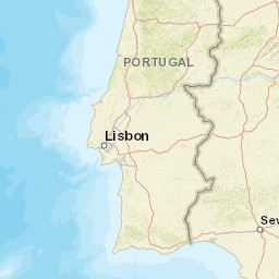


| Datetime (UTC) rmsOT_error |
Lat Smajor |
Lon Sminor |
D. (Km) AzErr |
Ndef mdist |
Nsta Mdist |
Gap | Mag1 (N) Err |
Mag2 (N) Err |
Mag3 (N) Err |
Author Quality |
|---|---|---|---|---|---|---|---|---|---|---|
| 2025-06-30T23:46:43.93Z 0.55+/- 0.8 |
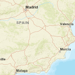
36.6377 6.3 |
-3.8463 3.8 |
25.3 1756.2 |
13 0.234 |
7 1.317 |
193.6 | ml 1.7 (6) 0.4 |
() |
() |
IGN m i ke |
| Sta | Dist | EvAz | Phase | Datetime | Tres | Azim | AzRes | Slow | SRes | Def | SNR | Amp | Per | Mag1 | Mag2 |
|---|---|---|---|---|---|---|---|---|---|---|---|---|---|---|---|
| EXSAL | 0.234 | 62.92 | Pg | 2025-06-30T23:46:49.707Z | 0 | ||||||||||
| EXSAL | 0.234 | 62.92 | Sg | 2025-06-30T23:46:53.612Z | -0.5 | ||||||||||
| ELGU | 0.29 | 37.47 | Pg | 2025-06-30T23:46:50.6Z | 0.1 | ||||||||||
| ELGU | 0.29 | 37.47 | Sg | 2025-06-30T23:46:55.676Z | 0.3 | 0.0000033331999999999997 | ML 2.3 | ||||||||
| EMAL | 0.484 | 285.04 | Pg | 2025-06-30T23:46:53.277Z | -0.1 | ||||||||||
| EMAL | 0.484 | 285.04 | Sg | 2025-06-30T23:46:59.803Z | -0.7 | ||||||||||
| EGOR | 0.517 | 335.96 | Pg | 2025-06-30T23:46:54.569Z | 0.7 | ||||||||||
| EGOR | 0.517 | 335.96 | Sg | 2025-06-30T23:47:01.43Z | 0 | 1.511e-7 | ML 1.2 | ||||||||
| EMIJ | 0.749 | 264.68 | Pg | 2025-06-30T23:46:56.735Z | -0.9 | ||||||||||
| EMIJ | 0.749 | 264.68 | Sg | 2025-06-30T23:47:04.832Z | -3.1 | 3.945e-7 | ML 1.8 | ||||||||
| EBER | 0.811 | 71.04 | Pg | 2025-06-30T23:46:59.413Z | 0.8 | ||||||||||
| EBER | 0.811 | 71.04 | Sg | 2025-06-30T23:47:09.676Z | 0 | 1.06e-7 | ML 1.3 | ||||||||
| EQES | 1.317 | 27.78 | Pg | 2025-06-30T23:47:06.106Z | -0.7 | ||||||||||
| EQES | 1.317 | 27.78 | Sg | 2025-06-30T23:47:23.42Z | -0.5 | 6.9e-8 | ML 1.4 | ||||||||
| Sta | Dist | EvAz | Phase | Datetime | Tres | Azim | AzRes | Slow | SRes | Def | SNR | Amp | Per | Mag1 | Mag2 |
| Centroid | Nodal Plan 1 | Nodal Plan 2 | Tensor | Moment Inf. | |||||||||||||||||
|---|---|---|---|---|---|---|---|---|---|---|---|---|---|---|---|---|---|---|---|---|---|
| Auth | Datetime | Lat | Lon | Depth | Mw | Strike | Dip | Rake | Strike | Dip | Rake | Mrr | Mtt | Mpp | Mrt | Mrp | Mtp | %DC | %ISO | %CLVD | |
| Auth | Datetime UTC | lat | lon | Depth | Mw | Strike | Dip | Rake | Strike | Dip | Rake | Mrr | Mtt | Mpp | Mrt | Mrp | Mtp | %DC | %ISO | %CLVD | |

