SeismicPortal
 is the European Infrastructure
 for seismological products in :
is the European Infrastructure 


| Datetime (UTC) rmsOT_error |
Lat Smajor |
Lon Sminor |
D. (Km) AzErr |
Ndef mdist |
Nsta Mdist |
Gap | Mag1 (N) Err |
Mag2 (N) Err |
Mag3 (N) Err |
Author Quality |
|---|---|---|---|---|---|---|---|---|---|---|
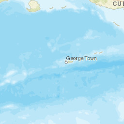
| 2025-06-30T18:10:51.98Z 0.09+/- |
17.9158 |
-66.839 |
13.1 0.25 |
22 0.07 |
11 0.605 |
225 | md 2.1 (7) 0.09 |
() |
() |
PR m i ke |
| Sta | Dist | EvAz | Phase | Datetime | Tres | Azim | AzRes | Slow | SRes | Def | SNR | Amp | Per | Mag1 | Mag2 |
|---|---|---|---|---|---|---|---|---|---|---|---|---|---|---|---|
| GBPR | 0.07 | 327.1 | P | 2025-06-30T18:10:54.66Z | -0.05 | ||||||||||
| GBPR | 0.07 | 327.1 | S | 2025-06-30T18:10:56.79Z | -0.05 | ||||||||||
| GNC1 | 0.087 | 309.98 | P | 2025-06-30T18:10:54.89Z | 0 | ||||||||||
| GNC1 | 0.087 | 309.98 | S | 2025-06-30T18:10:57.18Z | 0.02 | ||||||||||
| GYN1 | 0.113 | 23.79 | S | 2025-06-30T18:10:58.11Z | 0.38 | ||||||||||
| MLPR | 0.203 | 285.29 | P | 2025-06-30T18:10:56.61Z | 0.06 | ||||||||||
| MLPR | 0.203 | 285.29 | S | 2025-06-30T18:11:00.16Z | 0.05 | ||||||||||
| OBIP | 0.255 | 60.27 | P | 2025-06-30T18:10:57.23Z | -0.17 | ||||||||||
| PN03 | 0.255 | 60.27 | P | 2025-06-30T18:10:57.41Z | 0.01 | ||||||||||
| OBIP | 0.255 | 60.27 | S | 2025-06-30T18:11:01.78Z | 0.15 | ||||||||||
| PN03 | 0.255 | 60.27 | S | 2025-06-30T18:11:01.82Z | 0.19 | ||||||||||
| ISPR | 0.261 | 310.13 | S | 2025-06-30T18:11:02.14Z | 0.33 | ||||||||||
| CRPR | 0.273 | 289.21 | P | 2025-06-30T18:10:57.81Z | 0.11 | ||||||||||
| CRPR | 0.273 | 289.21 | S | 2025-06-30T18:11:01.93Z | -0.23 | ||||||||||
| CELP | 0.294 | 57.35 | P | 2025-06-30T18:10:57.94Z | -0.1 | ||||||||||
| CELP | 0.294 | 57.35 | S | 2025-06-30T18:11:02.9Z | 0.13 | ||||||||||
| LSP | 0.349 | 317.78 | P | 2025-06-30T18:10:59.2Z | 0.08 | ||||||||||
| LSP | 0.349 | 317.78 | S | 2025-06-30T18:11:04.44Z | 0.07 | ||||||||||
| UUPR | 0.354 | 18.63 | P | 2025-06-30T18:10:58.87Z | -0.14 | ||||||||||
| UUPR | 0.354 | 18.63 | S | 2025-06-30T18:11:04.37Z | -0.12 | ||||||||||
| AOPR | 0.436 | 10.67 | P | 2025-06-30T18:11:00.32Z | 0.02 | ||||||||||
| AOPR | 0.436 | 10.67 | S | 2025-06-30T18:11:06.73Z | -0.06 | ||||||||||
| ECPR | 0.605 | 48.39 | P | 2025-06-30T18:11:03.7Z | 0.12 | ||||||||||
| ECPR | 0.605 | 48.39 | S | 2025-06-30T18:11:11.48Z | -0.03 | ||||||||||
| Sta | Dist | EvAz | Phase | Datetime | Tres | Azim | AzRes | Slow | SRes | Def | SNR | Amp | Per | Mag1 | Mag2 |
| Centroid | Nodal Plan 1 | Nodal Plan 2 | Tensor | Moment Inf. | |||||||||||||||||
|---|---|---|---|---|---|---|---|---|---|---|---|---|---|---|---|---|---|---|---|---|---|
| Auth | Datetime | Lat | Lon | Depth | Mw | Strike | Dip | Rake | Strike | Dip | Rake | Mrr | Mtt | Mpp | Mrt | Mrp | Mtp | %DC | %ISO | %CLVD | |
| Auth | Datetime UTC | lat | lon | Depth | Mw | Strike | Dip | Rake | Strike | Dip | Rake | Mrr | Mtt | Mpp | Mrt | Mrp | Mtp | %DC | %ISO | %CLVD | |


