SeismicPortal
 is the European Infrastructure
 for seismological products in :
is the European Infrastructure 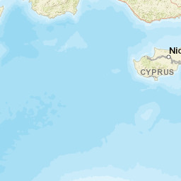
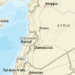


| Datetime (UTC) rmsOT_error |
Lat Smajor |
Lon Sminor |
D. (Km) AzErr |
Ndef mdist |
Nsta Mdist |
Gap | Mag1 (N) Err |
Mag2 (N) Err |
Mag3 (N) Err |
Author Quality |
|---|---|---|---|---|---|---|---|---|---|---|
| 2025-06-22T22:05:23.1Z +/- |
35.5958 |
31.4203 |
9.2 |
22 0.967 |
18 2.246 |
222.6 | ml 2.5 () |
() |
() |
KOERI m i ke |
| Sta | Dist | EvAz | Phase | Datetime | Tres | Azim | AzRes | Slow | SRes | Def | SNR | Amp | Per | Mag1 | Mag2 |
|---|---|---|---|---|---|---|---|---|---|---|---|---|---|---|---|
| GAZI | 0.967 | 48.48 | Pg | 2025-06-22T22:05:42.1Z | 0 | ||||||||||
| GAZI | 0.967 | 48.48 | Sg | 2025-06-22T22:05:56.0Z | 0 | ||||||||||
| LEF | 1.259 | 112.13 | Pn | 2025-06-22T22:05:47.5Z | 0 | ||||||||||
| LEF | 1.259 | 112.13 | Sn | 2025-06-22T22:06:05.1Z | 0 | ||||||||||
| AKDN | 1.298 | 102.78 | Pn | 2025-06-22T22:05:47.8Z | 0 | ||||||||||
| AKDN | 1.298 | 102.78 | Sn | 2025-06-22T22:06:06.1Z | 0 | ||||||||||
| HSY | 1.403 | 102.01 | Pn | 2025-06-22T22:05:49.5Z | 0 | ||||||||||
| LMOS | 1.441 | 45.44 | Pn | 2025-06-22T22:05:49.7Z | 0 | ||||||||||
| ANTB | 1.441 | 334.77 | Pn | 2025-06-22T22:05:50.3Z | 0 | ||||||||||
| TEKE | 1.48 | 67.87 | Pn | 2025-06-22T22:05:50.4Z | 0 | ||||||||||
| TEKE | 1.48 | 67.87 | Sn | 2025-06-22T22:06:10.7Z | 0 | ||||||||||
| HDMB | 1.614 | 31.92 | Pn | 2025-06-22T22:05:52.6Z | 0 | ||||||||||
| BERE | 1.643 | 62.32 | Pn | 2025-06-22T22:05:52.6Z | 0 | ||||||||||
| LFK | 1.754 | 99.64 | Pn | 2025-06-22T22:05:54.5Z | 0 | ||||||||||
| SEYD | 1.838 | 10.43 | Pn | 2025-06-22T22:05:55.4Z | 0 | ||||||||||
| TEVE | 1.842 | 62.33 | Pn | 2025-06-22T22:05:55.7Z | 0 | ||||||||||
| IKL | 1.946 | 70.14 | Pn | 2025-06-22T22:05:57.3Z | 0 | ||||||||||
| KARG | 1.954 | 71.27 | Pn | 2025-06-22T22:05:57.3Z | 0 | ||||||||||
| KEBE | 2.044 | 64.77 | Pn | 2025-06-22T22:05:59.5Z | 0 | ||||||||||
| MAGT | 2.047 | 101.28 | Pn | 2025-06-22T22:05:58.6Z | 0 | ||||||||||
| SILI | 2.171 | 68.51 | Pn | 2025-06-22T22:06:00.5Z | 0 | ||||||||||
| EREN | 2.246 | 90.9 | Pn | 2025-06-22T22:06:01.6Z | 0 | ||||||||||
| Sta | Dist | EvAz | Phase | Datetime | Tres | Azim | AzRes | Slow | SRes | Def | SNR | Amp | Per | Mag1 | Mag2 |
| Centroid | Nodal Plan 1 | Nodal Plan 2 | Tensor | Moment Inf. | |||||||||||||||||
|---|---|---|---|---|---|---|---|---|---|---|---|---|---|---|---|---|---|---|---|---|---|
| Auth | Datetime | Lat | Lon | Depth | Mw | Strike | Dip | Rake | Strike | Dip | Rake | Mrr | Mtt | Mpp | Mrt | Mrp | Mtp | %DC | %ISO | %CLVD | |
| Auth | Datetime UTC | lat | lon | Depth | Mw | Strike | Dip | Rake | Strike | Dip | Rake | Mrr | Mtt | Mpp | Mrt | Mrp | Mtp | %DC | %ISO | %CLVD | |

