SeismicPortal
 is the European Infrastructure
 for seismological products in :
is the European Infrastructure 


| Datetime (UTC) rmsOT_error |
Lat Smajor |
Lon Sminor |
D. (Km) AzErr |
Ndef mdist |
Nsta Mdist |
Gap | Mag1 (N) Err |
Mag2 (N) Err |
Mag3 (N) Err |
Author Quality |
|---|---|---|---|---|---|---|---|---|---|---|
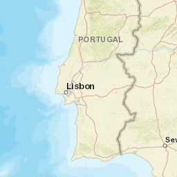
| 2025-06-14T03:48:45.8Z 0.27+/- 1.02 |
37.436 9.7 |
-24.681 2.3 |
10 81 |
15 0.516 |
9 0.84 |
260.2 | ml 1.9 (6) 0.2 |
() |
() |
PDA m i ke |
| Sta | Dist | EvAz | Phase | Datetime | Tres | Azim | AzRes | Slow | SRes | Def | SNR | Amp | Per | Mag1 | Mag2 |
|---|---|---|---|---|---|---|---|---|---|---|---|---|---|---|---|
| BART | 0.516 | 311.47 | P | 2025-06-14T03:48:54.34Z | -0.21 | ||||||||||
| BART | 0.516 | 311.47 | S | 2025-06-14T03:49:00.51Z | -0.6 | 6.7e-8 | ML 1.8 | ||||||||
| PSMN | 0.53 | 215.48 | S | 2025-06-14T03:49:01.38Z | 0.09 | 1.7899999999999998e-8 | |||||||||
| PSESP | 0.569 | 211.67 | P | 2025-06-14T03:48:55.27Z | 0.06 | ||||||||||
| PSESP | 0.569 | 211.67 | S | 2025-06-14T03:49:02.18Z | -0.08 | 3.46e-8 | |||||||||
| VPORT | 0.573 | 218.48 | P | 2025-06-14T03:48:55.16Z | -0.09 | ||||||||||
| VPORT | 0.573 | 218.48 | S | 2025-06-14T03:49:02.1Z | -0.22 | 1.6e-8 | |||||||||
| PGAR | 0.625 | 297.06 | P | 2025-06-14T03:48:56.2Z | 0.22 | ||||||||||
| PGAR | 0.625 | 297.06 | S | 2025-06-14T03:49:04.4Z | 0.43 | 1.114e-7 | |||||||||
| PGRON | 0.644 | 301.43 | P | 2025-06-14T03:48:56.4Z | 0.11 | ||||||||||
| PGRON | 0.644 | 301.43 | S | 2025-06-14T03:49:04.37Z | 0.21 | 6.36e-8 | ML 2 | ||||||||
| PFORM | 0.701 | 302.94 | S | 2025-06-14T03:49:05.3Z | -0.42 | 9.63e-8 | ML 2.1 | ||||||||
| CMLA | 0.745 | 296.32 | P | 2025-06-14T03:48:57.72Z | 0.04 | ||||||||||
| CMLA | 0.745 | 296.32 | S | 2025-06-14T03:49:06.69Z | 0.11 | 1.85e-8 | |||||||||
| PDA | 0.84 | 291.98 | P | 2025-06-14T03:48:59.3Z | 0.37 | 3.18e-8 | |||||||||
| Sta | Dist | EvAz | Phase | Datetime | Tres | Azim | AzRes | Slow | SRes | Def | SNR | Amp | Per | Mag1 | Mag2 |
| Centroid | Nodal Plan 1 | Nodal Plan 2 | Tensor | Moment Inf. | |||||||||||||||||
|---|---|---|---|---|---|---|---|---|---|---|---|---|---|---|---|---|---|---|---|---|---|
| Auth | Datetime | Lat | Lon | Depth | Mw | Strike | Dip | Rake | Strike | Dip | Rake | Mrr | Mtt | Mpp | Mrt | Mrp | Mtp | %DC | %ISO | %CLVD | |
| Auth | Datetime UTC | lat | lon | Depth | Mw | Strike | Dip | Rake | Strike | Dip | Rake | Mrr | Mtt | Mpp | Mrt | Mrp | Mtp | %DC | %ISO | %CLVD | |

