SeismicPortal
 is the European Infrastructure
 for seismological products in :
is the European Infrastructure 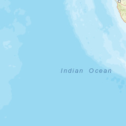


| Datetime (UTC) rmsOT_error |
Lat Smajor |
Lon Sminor |
D. (Km) AzErr |
Ndef mdist |
Nsta Mdist |
Gap | Mag1 (N) Err |
Mag2 (N) Err |
Mag3 (N) Err |
Author Quality |
|---|---|---|---|---|---|---|---|---|---|---|
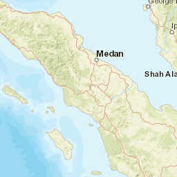
| 2025-05-19T08:04:21.704Z 0.89+/- 1.81 |
1.1557 20.69 |
97.1522 8.56 |
20.7 2416.788 |
40 2.342 |
40 99.403 |
199.4 | mb 4.7 (37) 0.09 |
() |
() |
NEIC m i ke |
| 2025-05-19T08:04:21.0Z +/- |
1.21 |
97.16 |
18 |
0 |
0 |
m 4.6 () |
() |
() |
BMKG m i ke |
| Sta | Dist | EvAz | Phase | Datetime | Tres | Azim | AzRes | Slow | SRes | Def | SNR | Amp | Per | Mag1 | Mag2 |
|---|---|---|---|---|---|---|---|---|---|---|---|---|---|---|---|
| PSI | 2.342 | 49.18 | Pn | 2025-05-19T08:04:59.14Z | 0.05 | ||||||||||
| PPI | 3.623 | 116.26 | Pn | 2025-05-19T08:05:15.12Z | -1.56 | ||||||||||
| LHMI | 4.056 | 357.11 | Pn | 2025-05-19T08:05:21.23Z | -1.32 | ||||||||||
| KOM | 6.73 | 84.53 | Pn | 2025-05-19T08:05:58.9Z | -0.38 | ||||||||||
| SRIT | 7.791 | 18.19 | Pn | 2025-05-19T08:06:12.35Z | -1.49 | ||||||||||
| BBJI | 13.541 | 129.43 | Pn | 2025-05-19T08:07:33.25Z | 0.65 | ||||||||||
| SBM | 15.126 | 84.9 | Pn | 2025-05-19T08:07:52.68Z | -1.48 | 7.65e-9 | 0.6 | mb 4.21 | |||||||
| CM31 | 17.301 | 5.73 | Pn | 2025-05-19T08:08:21.2Z | -0.78 | 9.05e-9 | 0.9 | mb 3.9 | |||||||
| CMAR | 17.301 | 5.73 | P | 2025-05-19T08:08:22.2Z | -1.12 | ||||||||||
| PHRA | 17.516 | 9.75 | P | 2025-05-19T08:08:23.44Z | -2.23 | 8.55e-9 | 0.94 | mb 3.86 | |||||||
| PANO | 17.523 | 24.37 | P | 2025-05-19T08:08:23.26Z | -2.5 | 1.185e-8 | 0.9 | mb 4.02 | |||||||
| CRAI | 19.235 | 9.22 | P | 2025-05-19T08:08:45.16Z | 0.55 | 3.115e-8 | 0.88 | mb 4.57 | |||||||
| NGU | 20.067 | 353.91 | P | 2025-05-19T08:08:52.96Z | -0.68 | 5.9e-8 | 0.32 | mb 5.37 | |||||||
| TOLI2 | 23.652 | 89.87 | P | 2025-05-19T08:09:29.99Z | -1.88 | 2.3e-8 | 0.7 | mb 4.83 | |||||||
| KKN | 28.857 | 337.8 | P | 2025-05-19T08:10:18.78Z | -0.23 | 8.4e-9 | 0.8 | mb 4.54 | |||||||
| NACB | 32.947 | 44.05 | P | 2025-05-19T08:10:55.45Z | 0.63 | 1.91e-8 | 0.9 | mb 5.03 | |||||||
| FITZ | 33.975 | 125.66 | P | 2025-05-19T08:11:02.72Z | -1.1 | 5.8e-9 | 1.4 | mb 4.32 | |||||||
| JOW | 39.341 | 46.79 | P | 2025-05-19T08:11:49.16Z | -0.36 | 3.225e-8 | 1.1 | mb 4.95 | |||||||
| WB10 | 42.065 | 121.65 | P | 2025-05-19T08:12:10.96Z | -1.12 | 1.645e-8 | 1.15 | mb 4.66 | |||||||
| WRAB | 42.108 | 121.89 | P | 2025-05-19T08:12:11.73Z | -0.7 | 1.805e-8 | 1.45 | mb 4.6 | |||||||
| MURGB | 42.601 | 332.86 | P | 2025-05-19T08:12:17.87Z | 1.07 | 4.45e-9 | 0.84 | mb 4.22 | |||||||
| ASAR | 43.447 | 127.04 | P | 2025-05-19T08:12:22.69Z | -0.62 | ||||||||||
| DRK | 44.634 | 331.87 | P | 2025-05-19T08:12:34.46Z | 1.53 | 4.065e-8 | 1.02 | mb 5.26 | |||||||
| TJN | 44.869 | 35.14 | P | 2025-05-19T08:12:33.78Z | -0.74 | 2.115e-8 | 1 | mb 5.01 | |||||||
| CHVK | 44.991 | 332.73 | P | 2025-05-19T08:12:36.7Z | 1.05 | 5.25e-9 | 0.9 | mb 4.47 | |||||||
| BTK | 45.554 | 331.52 | P | 2025-05-19T08:12:41.3Z | 0.97 | 8.05e-9 | 0.92 | mb 4.65 | |||||||
| KS31 | 45.911 | 34.49 | P | 2025-05-19T08:12:42.45Z | -0.6 | 1.43e-8 | 1.4 | mb 4.73 | |||||||
| KSAR | 45.911 | 34.49 | P | 2025-05-19T08:12:42.5Z | -0.27 | ||||||||||
| SONM | 47.202 | 8.48 | P | 2025-05-19T08:12:53.28Z | 0.29 | 5.65e-9 | 0.88 | mb 4.62 | |||||||
| JMN | 47.276 | 42.72 | P | 2025-05-19T08:12:52.98Z | -0.61 | 1.955e-8 | 1 | mb 5.11 | |||||||
| MKAR | 47.294 | 346.13 | P | 2025-05-19T08:12:54.13Z | 0.54 | ||||||||||
| ULN | 47.332 | 9.05 | P | 2025-05-19T08:12:54.13Z | 0.1 | 4.85e-9 | 0.75 | mb 4.63 | |||||||
| KKAR | 48.1 | 333.83 | P | 2025-05-19T08:13:00.71Z | 0.83 | ||||||||||
| KURK | 51.84 | 345.12 | P | 2025-05-19T08:13:28.25Z | 0.09 | 5.95e-9 | 1 | mb 4.47 | |||||||
| HILR | 51.973 | 18.51 | P | 2025-05-19T08:13:29.14Z | -0.1 | 5e-9 | 0.85 | mb 4.47 | |||||||
| USRK | 52.858 | 31.01 | P | 2025-05-19T08:13:35.86Z | 0.07 | ||||||||||
| USA0B | 52.859 | 31.01 | P | 2025-05-19T08:13:35.86Z | 0.07 | 1.54e-8 | 1 | mb 4.89 | |||||||
| STKA | 53.404 | 132.09 | P | 2025-05-19T08:13:39.64Z | -0.3 | 1.5e-8 | 0.85 | mb 4.99 | |||||||
| ZAA0B | 53.609 | 350.98 | P | 2025-05-19T08:13:41.3Z | 0.09 | 1.145e-8 | 0.85 | mb 4.89 | |||||||
| ZALV | 53.609 | 350.98 | P | 2025-05-19T08:13:41.47Z | 0.26 | ||||||||||
| CMSA | 56.348 | 129.76 | P | 2025-05-19T08:14:01.94Z | 0.69 | 1.465e-8 | 1.2 | mb 4.89 | |||||||
| ABK31 | 57.551 | 332.02 | P | 2025-05-19T08:14:09.78Z | 0.17 | 3.5e-9 | 0.8 | mb 4.44 | |||||||
| ABKAR | 57.551 | 332.02 | P | 2025-05-19T08:14:09.61Z | 0 | ||||||||||
| EIDS | 58.451 | 120.87 | P | 2025-05-19T08:14:16.45Z | 0.29 | 1.44e-8 | 1.15 | mb 4.94 | |||||||
| IMAR | 96.596 | 22.83 | P | 2025-05-19T08:17:50.21Z | 0.17 | ||||||||||
| P17K | 97.338 | 29.75 | P | 2025-05-19T08:17:52.53Z | -0.89 | 1.045e-8 | 1.04 | mb 5.33 | |||||||
| BMAR | 99.403 | 20.08 | P | 2025-05-19T08:18:03.56Z | 0.82 | ||||||||||
| Sta | Dist | EvAz | Phase | Datetime | Tres | Azim | AzRes | Slow | SRes | Def | SNR | Amp | Per | Mag1 | Mag2 |
| Sta | Dist | EvAz | Phase | Datetime | Tres | Azim | AzRes | Slow | SRes | Def | SNR | Amp | Per | Mag1 | Mag2 |
|---|---|---|---|---|---|---|---|---|---|---|---|---|---|---|---|
| Sta | Dist | EvAz | Phase | Datetime | Tres | Azim | AzRes | Slow | SRes | Def | SNR | Amp | Per | Mag1 | Mag2 |
| Centroid | Nodal Plan 1 | Nodal Plan 2 | Tensor | Moment Inf. | |||||||||||||||||
|---|---|---|---|---|---|---|---|---|---|---|---|---|---|---|---|---|---|---|---|---|---|
| Auth | Datetime | Lat | Lon | Depth | Mw | Strike | Dip | Rake | Strike | Dip | Rake | Mrr | Mtt | Mpp | Mrt | Mrp | Mtp | %DC | %ISO | %CLVD | |
| Auth | Datetime UTC | lat | lon | Depth | Mw | Strike | Dip | Rake | Strike | Dip | Rake | Mrr | Mtt | Mpp | Mrt | Mrp | Mtp | %DC | %ISO | %CLVD | |

