SeismicPortal
 is the European Infrastructure
 for seismological products in :
is the European Infrastructure 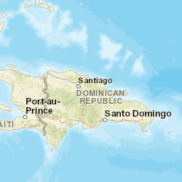


| Datetime (UTC) rmsOT_error |
Lat Smajor |
Lon Sminor |
D. (Km) AzErr |
Ndef mdist |
Nsta Mdist |
Gap | Mag1 (N) Err |
Mag2 (N) Err |
Mag3 (N) Err |
Author Quality |
|---|---|---|---|---|---|---|---|---|---|---|
| 2025-05-17T05:52:34.66Z 0.18+/- |
17.919 |
-66.8433 |
16.4 0.69 |
19 0.058 |
10 0.434 |
223.4 | md 2.2 (4) 0.08 |
() |
() |
PR m i ke |
| Sta | Dist | EvAz | Phase | Datetime | Tres | Azim | AzRes | Slow | SRes | Def | SNR | Amp | Per | Mag1 | Mag2 |
|---|---|---|---|---|---|---|---|---|---|---|---|---|---|---|---|
| GNC2 | 0.058 | 335.99 | P | 2025-05-17T05:52:37.84Z | 0.14 | ||||||||||
| GNC2 | 0.058 | 335.99 | S | 2025-05-17T05:52:40.28Z | 0.2 | ||||||||||
| GBPR | 0.065 | 328.64 | P | 2025-05-17T05:52:37.87Z | 0.12 | ||||||||||
| GBPR | 0.065 | 328.64 | S | 2025-05-17T05:52:40.19Z | 0.03 | ||||||||||
| GNC1 | 0.082 | 310.15 | P | 2025-05-17T05:52:37.9Z | 0.01 | ||||||||||
| GNC1 | 0.082 | 310.15 | S | 2025-05-17T05:52:40.3Z | -0.11 | ||||||||||
| YAC2 | 0.104 | 352.32 | S | 2025-05-17T05:52:40.67Z | -0.13 | ||||||||||
| MLPR | 0.198 | 284.72 | P | 2025-05-17T05:52:39.28Z | -0.03 | ||||||||||
| MLPR | 0.198 | 284.72 | S | 2025-05-17T05:52:42.74Z | -0.2 | ||||||||||
| OBIP | 0.258 | 61.33 | P | 2025-05-17T05:52:40.18Z | -0.01 | ||||||||||
| OBIP | 0.258 | 61.33 | S | 2025-05-17T05:52:44.15Z | -0.35 | ||||||||||
| CRPR | 0.268 | 288.86 | P | 2025-05-17T05:52:40.31Z | -0.04 | ||||||||||
| CRPR | 0.268 | 288.86 | S | 2025-05-17T05:52:44.42Z | -0.37 | ||||||||||
| CELP | 0.296 | 58.29 | P | 2025-05-17T05:52:40.82Z | 0.05 | ||||||||||
| CELP | 0.296 | 58.29 | S | 2025-05-17T05:52:45.63Z | 0.09 | ||||||||||
| LSP | 0.344 | 317.94 | P | 2025-05-17T05:52:41.71Z | 0.19 | ||||||||||
| LSP | 0.344 | 317.94 | S | 2025-05-17T05:52:47.19Z | 0.32 | ||||||||||
| AOPR | 0.434 | 11.28 | P | 2025-05-17T05:52:43.8Z | 0.16 | ||||||||||
| AOPR | 0.434 | 11.28 | S | 2025-05-17T05:52:49.15Z | -0.21 | ||||||||||
| Sta | Dist | EvAz | Phase | Datetime | Tres | Azim | AzRes | Slow | SRes | Def | SNR | Amp | Per | Mag1 | Mag2 |
| Centroid | Nodal Plan 1 | Nodal Plan 2 | Tensor | Moment Inf. | |||||||||||||||||
|---|---|---|---|---|---|---|---|---|---|---|---|---|---|---|---|---|---|---|---|---|---|
| Auth | Datetime | Lat | Lon | Depth | Mw | Strike | Dip | Rake | Strike | Dip | Rake | Mrr | Mtt | Mpp | Mrt | Mrp | Mtp | %DC | %ISO | %CLVD | |
| Auth | Datetime UTC | lat | lon | Depth | Mw | Strike | Dip | Rake | Strike | Dip | Rake | Mrr | Mtt | Mpp | Mrt | Mrp | Mtp | %DC | %ISO | %CLVD | |


