SeismicPortal
 is the European Infrastructure
 for seismological products in :
is the European Infrastructure 


| Datetime (UTC) rmsOT_error |
Lat Smajor |
Lon Sminor |
D. (Km) AzErr |
Ndef mdist |
Nsta Mdist |
Gap | Mag1 (N) Err |
Mag2 (N) Err |
Mag3 (N) Err |
Author Quality |
|---|---|---|---|---|---|---|---|---|---|---|
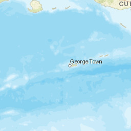
| 2025-05-16T14:51:01.7Z 0.11+/- |
17.9688 |
-66.8287 |
16.5 0.38 |
22 0.038 |
13 0.58 |
199.4 | md 2.2 (9) 0.14 |
() |
() |
PR m i ke |
| Sta | Dist | EvAz | Phase | Datetime | Tres | Azim | AzRes | Slow | SRes | Def | SNR | Amp | Per | Mag1 | Mag2 |
|---|---|---|---|---|---|---|---|---|---|---|---|---|---|---|---|
| GNC2 | 0.038 | 274.81 | P | 2025-05-16T14:51:04.13Z | 0.12 | ||||||||||
| GNC2 | 0.038 | 274.81 | S | 2025-05-16T14:51:06.32Z | 0.02 | ||||||||||
| GBPR | 0.048 | 277.3 | P | 2025-05-16T14:51:04.1Z | 0.04 | ||||||||||
| GBPR | 0.048 | 277.3 | S | 2025-05-16T14:51:06.57Z | 0.18 | ||||||||||
| GYN1 | 0.062 | 35.16 | P | 2025-05-16T14:51:04.23Z | 0.07 | ||||||||||
| GYN1 | 0.062 | 35.16 | S | 2025-05-16T14:51:06.62Z | 0.07 | ||||||||||
| MLPR | 0.205 | 270.19 | P | 2025-05-16T14:51:05.78Z | -0.05 | ||||||||||
| MLPR | 0.205 | 270.19 | S | 2025-05-16T14:51:09.38Z | -0.16 | ||||||||||
| PN03 | 0.225 | 70.77 | P | 2025-05-16T14:51:05.97Z | -0.14 | ||||||||||
| PN03 | 0.225 | 70.77 | S | 2025-05-16T14:51:09.94Z | -0.1 | ||||||||||
| CELP | 0.26 | 66 | P | 2025-05-16T14:51:06.63Z | -0.01 | ||||||||||
| CELP | 0.26 | 66 | S | 2025-05-16T14:51:11.5Z | 0.07 | ||||||||||
| CRPR | 0.271 | 277.9 | P | 2025-05-16T14:51:06.61Z | -0.18 | ||||||||||
| CRPR | 0.271 | 277.9 | S | 2025-05-16T14:51:10.78Z | -0.47 | ||||||||||
| UUPR | 0.301 | 20.07 | P | 2025-05-16T14:51:07.8Z | -0.18 | ||||||||||
| UUPR | 0.301 | 20.07 | S | 2025-05-16T14:51:11.6Z | -0.49 | ||||||||||
| LSP | 0.32 | 310.11 | P | 2025-05-16T14:51:07.49Z | -0.06 | ||||||||||
| LSP | 0.32 | 310.11 | S | 2025-05-16T14:51:12.77Z | 0.17 | ||||||||||
| AOPR | 0.383 | 10.69 | P | 2025-05-16T14:51:08.48Z | -0.05 | ||||||||||
| AOPR | 0.383 | 10.69 | S | 2025-05-16T14:51:14.16Z | -0.19 | ||||||||||
| ECPR | 0.564 | 51.74 | P | 2025-05-16T14:51:11.42Z | 0.13 | ||||||||||
| ECPR | 0.564 | 51.74 | S | 2025-05-16T14:51:19.73Z | 0.47 | ||||||||||
| AGPR | 0.565 | 331.65 | P | 2025-05-16T14:51:11.39Z | 0.09 | ||||||||||
| AGPR | 0.565 | 331.65 | S | 2025-05-16T14:51:19.46Z | 0.18 | ||||||||||
| EMPR | 0.58 | 29.31 | P | 2025-05-16T14:51:11.98Z | 0.46 | ||||||||||
| EMPR | 0.58 | 29.31 | S | 2025-05-16T14:51:19.88Z | 0.21 | ||||||||||
| Sta | Dist | EvAz | Phase | Datetime | Tres | Azim | AzRes | Slow | SRes | Def | SNR | Amp | Per | Mag1 | Mag2 |
| Centroid | Nodal Plan 1 | Nodal Plan 2 | Tensor | Moment Inf. | |||||||||||||||||
|---|---|---|---|---|---|---|---|---|---|---|---|---|---|---|---|---|---|---|---|---|---|
| Auth | Datetime | Lat | Lon | Depth | Mw | Strike | Dip | Rake | Strike | Dip | Rake | Mrr | Mtt | Mpp | Mrt | Mrp | Mtp | %DC | %ISO | %CLVD | |
| Auth | Datetime UTC | lat | lon | Depth | Mw | Strike | Dip | Rake | Strike | Dip | Rake | Mrr | Mtt | Mpp | Mrt | Mrp | Mtp | %DC | %ISO | %CLVD | |


