SeismicPortal
 is the European Infrastructure
 for seismological products in :
is the European Infrastructure 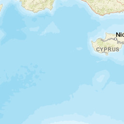


| Datetime (UTC) rmsOT_error |
Lat Smajor |
Lon Sminor |
D. (Km) AzErr |
Ndef mdist |
Nsta Mdist |
Gap | Mag1 (N) Err |
Mag2 (N) Err |
Mag3 (N) Err |
Author Quality |
|---|---|---|---|---|---|---|---|---|---|---|
| 2025-05-13T02:04:39.0Z 0.5+/- |
35.6669 |
30.9981 |
11.8 |
17 0.843 |
9 2.458 |
237 | ml 2 () |
() |
() |
AFAD m i ke |
| Sta | Dist | EvAz | Phase | Datetime | Tres | Azim | AzRes | Slow | SRes | Def | SNR | Amp | Per | Mag1 | Mag2 |
|---|---|---|---|---|---|---|---|---|---|---|---|---|---|---|---|
| AKUM | 0.843 | 321.12 | S | 2025-05-13T02:04:56.2Z | -0.03 | ||||||||||
| AKUM | 0.843 | 321.12 | P | 2025-05-13T02:04:56.2Z | -0.08 | ||||||||||
| GAZI | 1.21 | 61.69 | S | 2025-05-13T02:05:02.37Z | 0.21 | ||||||||||
| GAZI | 1.21 | 61.69 | P | 2025-05-13T02:05:02.37Z | -0.15 | ||||||||||
| KEPZ | 1.325 | 21.5 | S | 2025-05-13T02:05:01.93Z | -4.49 | ||||||||||
| KEPZ | 1.325 | 21.5 | P | 2025-05-13T02:05:01.93Z | -2.33 | ||||||||||
| KORT | 1.43 | 338.73 | S | 2025-05-13T02:05:02.67Z | 0.34 | ||||||||||
| KORT | 1.43 | 338.73 | P | 2025-05-13T02:05:02.67Z | -3.01 | ||||||||||
| IZZE | 1.629 | 298.66 | S | 2025-05-13T02:05:00.7Z | 0 | ||||||||||
| IZZE | 1.629 | 298.66 | P | 2025-05-13T02:05:00.7Z | 0 | ||||||||||
| KNIK | 1.646 | 316.02 | S | 2025-05-13T02:05:08.72Z | 0.32 | ||||||||||
| KNIK | 1.646 | 316.02 | P | 2025-05-13T02:05:08.72Z | 0.15 | ||||||||||
| FETY | 1.826 | 302.51 | S | 2025-05-13T02:05:11.3Z | -0.86 | ||||||||||
| FETY | 1.826 | 302.51 | P | 2025-05-13T02:05:11.3Z | 0.21 | ||||||||||
| SEDI | 1.882 | 18.67 | S | 2025-05-13T02:05:11.34Z | -0.01 | ||||||||||
| SEDI | 1.882 | 18.67 | P | 2025-05-13T02:05:11.34Z | -0.61 | ||||||||||
| GOLH | 1.949 | 323.9 | S | 2025-05-13T02:05:13.84Z | 0 | ||||||||||
| GOLH | 1.949 | 323.9 | P | 2025-05-13T02:05:13.84Z | 0.97 | ||||||||||
| TAVA | 2.458 | 317.54 | S | 2025-05-13T02:05:20.5Z | -0.5 | ||||||||||
| TAVA | 2.458 | 317.54 | P | 2025-05-13T02:05:20.5Z | 0.25 | ||||||||||
| Sta | Dist | EvAz | Phase | Datetime | Tres | Azim | AzRes | Slow | SRes | Def | SNR | Amp | Per | Mag1 | Mag2 |
| Centroid | Nodal Plan 1 | Nodal Plan 2 | Tensor | Moment Inf. | |||||||||||||||||
|---|---|---|---|---|---|---|---|---|---|---|---|---|---|---|---|---|---|---|---|---|---|
| Auth | Datetime | Lat | Lon | Depth | Mw | Strike | Dip | Rake | Strike | Dip | Rake | Mrr | Mtt | Mpp | Mrt | Mrp | Mtp | %DC | %ISO | %CLVD | |
| Auth | Datetime UTC | lat | lon | Depth | Mw | Strike | Dip | Rake | Strike | Dip | Rake | Mrr | Mtt | Mpp | Mrt | Mrp | Mtp | %DC | %ISO | %CLVD | |

