SeismicPortal
 is the European Infrastructure
 for seismological products in :
is the European Infrastructure 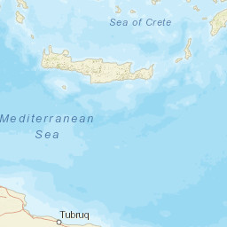


| Datetime (UTC) rmsOT_error |
Lat Smajor |
Lon Sminor |
D. (Km) AzErr |
Ndef mdist |
Nsta Mdist |
Gap | Mag1 (N) Err |
Mag2 (N) Err |
Mag3 (N) Err |
Author Quality |
|---|---|---|---|---|---|---|---|---|---|---|
| 2025-05-06T14:20:26.0Z 0.48+/- |
36.0986 |
28.1358 |
7.2 |
15 0.536 |
8 1.612 |
233.6 | ml 1.9 () |
() |
() |
AFAD m i ke |
| Sta | Dist | EvAz | Phase | Datetime | Tres | Azim | AzRes | Slow | SRes | Def | SNR | Amp | Per | Mag1 | Mag2 |
|---|---|---|---|---|---|---|---|---|---|---|---|---|---|---|---|
| TASL | 0.536 | 356.83 | S | 2025-05-06T14:20:36.94Z | 0.55 | ||||||||||
| TASL | 0.536 | 356.83 | P | 2025-05-06T14:20:36.94Z | -0.45 | ||||||||||
| YAZI | 0.801 | 316.75 | S | 2025-05-06T14:20:42.41Z | 0.34 | ||||||||||
| YAZI | 0.801 | 316.75 | P | 2025-05-06T14:20:42.41Z | 0.31 | ||||||||||
| DALY | 0.828 | 30.06 | S | 2025-05-06T14:20:42.41Z | 3.61 | ||||||||||
| DALY | 0.828 | 30.06 | P | 2025-05-06T14:20:42.41Z | -0.12 | ||||||||||
| FETY | 0.934 | 54.75 | S | 2025-05-06T14:20:43.99Z | 0.27 | ||||||||||
| FETY | 0.934 | 54.75 | P | 2025-05-06T14:20:43.99Z | -0.71 | ||||||||||
| IZZE | 0.943 | 68.71 | S | 2025-05-06T14:20:38.45Z | -7.07 | ||||||||||
| IZZE | 0.943 | 68.71 | P | 2025-05-06T14:20:38.45Z | -7.34 | ||||||||||
| SABU | 0.987 | 42.62 | S | 2025-05-06T14:20:44.97Z | 0.08 | ||||||||||
| SABU | 0.987 | 42.62 | P | 2025-05-06T14:20:44.97Z | -0.63 | ||||||||||
| BDRM | 1.114 | 330.19 | S | 2025-05-06T14:20:47.68Z | -0.35 | ||||||||||
| BDRM | 1.114 | 330.19 | P | 2025-05-06T14:20:47.68Z | -0.2 | ||||||||||
| AKAS | 1.196 | 83.13 | S | 2025-05-06T14:20:50.38Z | 5.18 | ||||||||||
| AKAS | 1.196 | 83.13 | P | 2025-05-06T14:20:50.38Z | 1 | ||||||||||
| GOLH | 1.612 | 44.79 | S | 2025-05-06T14:21:02.56Z | 8.73 | ||||||||||
| GOLH | 1.612 | 44.79 | P | 2025-05-06T14:21:02.56Z | 5.53 | ||||||||||
| Sta | Dist | EvAz | Phase | Datetime | Tres | Azim | AzRes | Slow | SRes | Def | SNR | Amp | Per | Mag1 | Mag2 |
| Centroid | Nodal Plan 1 | Nodal Plan 2 | Tensor | Moment Inf. | |||||||||||||||||
|---|---|---|---|---|---|---|---|---|---|---|---|---|---|---|---|---|---|---|---|---|---|
| Auth | Datetime | Lat | Lon | Depth | Mw | Strike | Dip | Rake | Strike | Dip | Rake | Mrr | Mtt | Mpp | Mrt | Mrp | Mtp | %DC | %ISO | %CLVD | |
| Auth | Datetime UTC | lat | lon | Depth | Mw | Strike | Dip | Rake | Strike | Dip | Rake | Mrr | Mtt | Mpp | Mrt | Mrp | Mtp | %DC | %ISO | %CLVD | |

