SeismicPortal
 is the European Infrastructure
 for seismological products in :
is the European Infrastructure 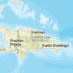


| Datetime (UTC) rmsOT_error |
Lat Smajor |
Lon Sminor |
D. (Km) AzErr |
Ndef mdist |
Nsta Mdist |
Gap | Mag1 (N) Err |
Mag2 (N) Err |
Mag3 (N) Err |
Author Quality |
|---|---|---|---|---|---|---|---|---|---|---|
| 2025-04-27T10:50:36.36Z 0.08+/- |
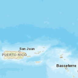
17.9603 |
-66.8148 |
15.9 0.62 |
13 0.052 |
8 0.405 |
209.4 | md 2.3 (5) 0.05 |
() |
() |
PR m i ke |
| Sta | Dist | EvAz | Phase | Datetime | Tres | Azim | AzRes | Slow | SRes | Def | SNR | Amp | Per | Mag1 | Mag2 |
|---|---|---|---|---|---|---|---|---|---|---|---|---|---|---|---|
| GNC2 | 0.052 | 282.92 | P | 2025-04-27T10:50:39.33Z | 0.02 | ||||||||||
| GNC2 | 0.052 | 282.92 | S | 2025-04-27T10:50:41.4Z | -0.21 | ||||||||||
| GBPR | 0.063 | 283.44 | P | 2025-04-27T10:50:39.44Z | 0.06 | ||||||||||
| GBPR | 0.063 | 283.44 | S | 2025-04-27T10:50:41.84Z | 0.1 | ||||||||||
| MLPR | 0.219 | 272.4 | P | 2025-04-27T10:50:41.3Z | 0.01 | ||||||||||
| MLPR | 0.219 | 272.4 | S | 2025-04-27T10:50:45.4Z | -0.1 | ||||||||||
| CELP | 0.252 | 63.02 | P | 2025-04-27T10:50:41.78Z | 0 | ||||||||||
| CELP | 0.252 | 63.02 | S | 2025-04-27T10:50:45.96Z | -0.05 | ||||||||||
| CRPR | 0.285 | 279.23 | P | 2025-04-27T10:50:42.32Z | 0.04 | ||||||||||
| CRPR | 0.285 | 279.23 | S | 2025-04-27T10:50:46.73Z | -0.17 | ||||||||||
| UUPR | 0.305 | 17.2 | P | 2025-04-27T10:50:42.49Z | -0.11 | ||||||||||
| UUPR | 0.305 | 17.2 | S | 2025-04-27T10:50:46.92Z | -0.55 | ||||||||||
| AOPR | 0.389 | 8.55 | P | 2025-04-27T10:50:43.91Z | 0 | ||||||||||
| AOPR | 0.389 | 8.55 | S | 2025-04-27T10:50:49.1Z | -0.7 | ||||||||||
| PRSN | 0.405 | 309.16 | P | 2025-04-27T10:50:44.71Z | 0.56 | ||||||||||
| PRSN | 0.405 | 309.16 | S | 2025-04-27T10:50:50.38Z | 0.15 | ||||||||||
| Sta | Dist | EvAz | Phase | Datetime | Tres | Azim | AzRes | Slow | SRes | Def | SNR | Amp | Per | Mag1 | Mag2 |
| Centroid | Nodal Plan 1 | Nodal Plan 2 | Tensor | Moment Inf. | |||||||||||||||||
|---|---|---|---|---|---|---|---|---|---|---|---|---|---|---|---|---|---|---|---|---|---|
| Auth | Datetime | Lat | Lon | Depth | Mw | Strike | Dip | Rake | Strike | Dip | Rake | Mrr | Mtt | Mpp | Mrt | Mrp | Mtp | %DC | %ISO | %CLVD | |
| Auth | Datetime UTC | lat | lon | Depth | Mw | Strike | Dip | Rake | Strike | Dip | Rake | Mrr | Mtt | Mpp | Mrt | Mrp | Mtp | %DC | %ISO | %CLVD | |


