SeismicPortal
 is the European Infrastructure
 for seismological products in :
is the European Infrastructure 


| Datetime (UTC) rmsOT_error |
Lat Smajor |
Lon Sminor |
D. (Km) AzErr |
Ndef mdist |
Nsta Mdist |
Gap | Mag1 (N) Err |
Mag2 (N) Err |
Mag3 (N) Err |
Author Quality |
|---|---|---|---|---|---|---|---|---|---|---|
| 2025-04-23T10:08:31.920594Z 2.78+/- |
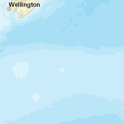
-43.8631 250.96 |
171.2049 130.8 |
280.2 113.60567383586522122.919721735069 |
8 0.184 |
8 2.37 |
150.8 | m 3.2 (3) |
() |
() |
GNS a i ke |
| Sta | Dist | EvAz | Phase | Datetime | Tres | Azim | AzRes | Slow | SRes | Def | SNR | Amp | Per | Mag1 | Mag2 |
|---|---|---|---|---|---|---|---|---|---|---|---|---|---|---|---|
| RPZ | 0.184 | 323.51 | P | 2025-04-23T10:09:10.81Z | 3.024 | ||||||||||
| DBHZ | 0.58 | 8 | P | 2025-04-23T10:09:09.76Z | |||||||||||
| SMRZ | 0.753 | 332.07 | P | 2025-04-23T10:09:08.35Z | |||||||||||
| HORZ | 0.8 | 275.77 | P | 2025-04-23T10:09:10.0Z | |||||||||||
| OXZ | 0.809 | 48.72 | P | 2025-04-23T10:09:17.59Z | 8.462 | ||||||||||
| IFMZ | 0.845 | 352.82 | P | 2025-04-23T10:09:10.45Z | |||||||||||
| WVZ | 0.859 | 336.48 | P | 2025-04-23T10:09:10.1313Z | 0.369 | ||||||||||
| FOZ | 1.06 | 287.69 | P | 2025-04-23T10:09:09.54313Z | -1.239 | ML 3.1715406583912804 | |||||||||
| SLTZ | 1.166 | 267.15 | P | 2025-04-23T10:09:09.34Z | |||||||||||
| HPRZ | 1.321 | 18.5 | P | 2025-04-23T10:09:11.31Z | |||||||||||
| LTZ | 1.331 | 36.12 | P | 2025-04-23T10:09:12.44Z | 0.697 | ML 2.9597007123695596 | |||||||||
| GVZ | 1.606 | 56.74 | P | 2025-04-23T10:09:12.86Z | -0.634 | ||||||||||
| KHZ | 2.237 | 50.55 | P | 2025-04-23T10:09:14.63Z | -3.869 | ML 3.60110552066578 | |||||||||
| TUZ | 2.37 | 207.59 | P | 2025-04-23T10:09:18.33Z | -1.924 | ||||||||||
| Sta | Dist | EvAz | Phase | Datetime | Tres | Azim | AzRes | Slow | SRes | Def | SNR | Amp | Per | Mag1 | Mag2 |
| Centroid | Nodal Plan 1 | Nodal Plan 2 | Tensor | Moment Inf. | |||||||||||||||||
|---|---|---|---|---|---|---|---|---|---|---|---|---|---|---|---|---|---|---|---|---|---|
| Auth | Datetime | Lat | Lon | Depth | Mw | Strike | Dip | Rake | Strike | Dip | Rake | Mrr | Mtt | Mpp | Mrt | Mrp | Mtp | %DC | %ISO | %CLVD | |
| Auth | Datetime UTC | lat | lon | Depth | Mw | Strike | Dip | Rake | Strike | Dip | Rake | Mrr | Mtt | Mpp | Mrt | Mrp | Mtp | %DC | %ISO | %CLVD | |

