SeismicPortal
 is the European Infrastructure
 for seismological products in :
is the European Infrastructure 


| Datetime (UTC) rmsOT_error |
Lat Smajor |
Lon Sminor |
D. (Km) AzErr |
Ndef mdist |
Nsta Mdist |
Gap | Mag1 (N) Err |
Mag2 (N) Err |
Mag3 (N) Err |
Author Quality |
|---|---|---|---|---|---|---|---|---|---|---|
| 2025-04-19T17:10:10.0Z 0.24+/- |
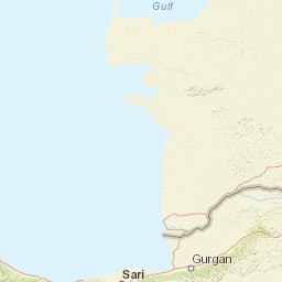
38.1589 |
37.8053 |
6.9 |
20 0.071 |
11 1.081 |
165.4 | ml 1.7 () |
() |
() |
AFAD m i ke |
| Sta | Dist | EvAz | Phase | Datetime | Tres | Azim | AzRes | Slow | SRes | Def | SNR | Amp | Per | Mag1 | Mag2 |
|---|---|---|---|---|---|---|---|---|---|---|---|---|---|---|---|
| MTOP | 0.071 | 147.63 | S | 2025-04-19T17:10:15.43Z | 0.07 | ||||||||||
| MTOP | 0.071 | 147.63 | P | 2025-04-19T17:10:15.43Z | 1.62 | ||||||||||
| AKCD | 0.165 | 33.85 | S | 2025-04-19T17:10:15.14Z | 1.83 | ||||||||||
| AKCD | 0.165 | 33.85 | P | 2025-04-19T17:10:15.14Z | 1.24 | ||||||||||
| AKCA | 0.376 | 194.29 | S | 2025-04-19T17:10:17.64Z | 0.11 | ||||||||||
| AKCA | 0.376 | 194.29 | P | 2025-04-19T17:10:17.64Z | -0.16 | ||||||||||
| MHAV | 0.393 | 167.76 | S | 2025-04-19T17:10:17.98Z | -0.02 | ||||||||||
| MHAV | 0.393 | 167.76 | P | 2025-04-19T17:10:17.98Z | -0.09 | ||||||||||
| MYES | 0.508 | 111.27 | S | 2025-04-19T17:10:20.24Z | 0.34 | ||||||||||
| MYES | 0.508 | 111.27 | P | 2025-04-19T17:10:20.24Z | -0.05 | ||||||||||
| MAYA | 0.516 | 71.01 | S | 2025-04-19T17:10:20.75Z | 0.19 | ||||||||||
| MAYA | 0.516 | 71.01 | P | 2025-04-19T17:10:20.75Z | 0.34 | ||||||||||
| MENG | 0.574 | 228.42 | S | 2025-04-19T17:10:21.38Z | 0.36 | ||||||||||
| MENG | 0.574 | 228.42 | P | 2025-04-19T17:10:21.38Z | -0.13 | ||||||||||
| MKAM | 0.709 | 76.41 | S | 2025-04-19T17:10:23.93Z | -0.43 | ||||||||||
| MKAM | 0.709 | 76.41 | P | 2025-04-19T17:10:23.93Z | 0.03 | ||||||||||
| MGND | 0.751 | 204.06 | S | 2025-04-19T17:10:24.66Z | -0.38 | ||||||||||
| MGND | 0.751 | 204.06 | P | 2025-04-19T17:10:24.66Z | 0.04 | ||||||||||
| GZT | 0.825 | 193.62 | P | 2025-04-19T17:10:27.15Z | 1.4 | ||||||||||
| ELZG | 0.987 | 69.57 | S | 2025-04-19T17:10:28.91Z | -0.32 | ||||||||||
| ELZG | 0.987 | 69.57 | P | 2025-04-19T17:10:28.91Z | -0.27 | ||||||||||
| HANM | 1.029 | 123.86 | S | 2025-04-19T17:10:29.65Z | 1.42 | ||||||||||
| HANM | 1.029 | 123.86 | P | 2025-04-19T17:10:29.65Z | -0.19 | ||||||||||
| KHMR | 1.081 | 221.43 | S | 2025-04-19T17:10:31.8Z | 1.11 | ||||||||||
| KHMR | 1.081 | 221.43 | P | 2025-04-19T17:10:31.8Z | 1.26 | ||||||||||
| Sta | Dist | EvAz | Phase | Datetime | Tres | Azim | AzRes | Slow | SRes | Def | SNR | Amp | Per | Mag1 | Mag2 |
| Centroid | Nodal Plan 1 | Nodal Plan 2 | Tensor | Moment Inf. | |||||||||||||||||
|---|---|---|---|---|---|---|---|---|---|---|---|---|---|---|---|---|---|---|---|---|---|
| Auth | Datetime | Lat | Lon | Depth | Mw | Strike | Dip | Rake | Strike | Dip | Rake | Mrr | Mtt | Mpp | Mrt | Mrp | Mtp | %DC | %ISO | %CLVD | |
| Auth | Datetime UTC | lat | lon | Depth | Mw | Strike | Dip | Rake | Strike | Dip | Rake | Mrr | Mtt | Mpp | Mrt | Mrp | Mtp | %DC | %ISO | %CLVD | |

