SeismicPortal
 is the European Infrastructure
 for seismological products in :
is the European Infrastructure 


| Datetime (UTC) rmsOT_error |
Lat Smajor |
Lon Sminor |
D. (Km) AzErr |
Ndef mdist |
Nsta Mdist |
Gap | Mag1 (N) Err |
Mag2 (N) Err |
Mag3 (N) Err |
Author Quality |
|---|---|---|---|---|---|---|---|---|---|---|
| 2025-04-04T21:01:00.0Z 0.85+/- |
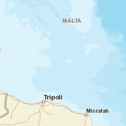
36.9411 |
28.8264 |
7 |
33 0.164 |
18 1.562 |
80.8 | ml 1.6 () |
() |
() |
AFAD m i ke |
| Sta | Dist | EvAz | Phase | Datetime | Tres | Azim | AzRes | Slow | SRes | Def | SNR | Amp | Per | Mag1 | Mag2 |
|---|---|---|---|---|---|---|---|---|---|---|---|---|---|---|---|
| SABU | 0.164 | 135.84 | P | 2025-04-04T21:01:02.82Z | -0.77 | ||||||||||
| DALY | 0.187 | 228.12 | S | 2025-04-04T21:01:03.79Z | 0 | ||||||||||
| DALY | 0.187 | 228.12 | P | 2025-04-04T21:01:03.79Z | -0.34 | ||||||||||
| FETY | 0.369 | 145.83 | S | 2025-04-04T21:01:06.95Z | 0.33 | ||||||||||
| FETY | 0.369 | 145.83 | P | 2025-04-04T21:01:06.95Z | -0.5 | ||||||||||
| CAEL | 0.435 | 65.17 | S | 2025-04-04T21:01:09.37Z | 0.65 | ||||||||||
| CAEL | 0.435 | 65.17 | P | 2025-04-04T21:01:09.37Z | 0.53 | ||||||||||
| TURN | 0.496 | 250.63 | S | 2025-04-04T21:01:09.53Z | 0.77 | ||||||||||
| TURN | 0.496 | 250.63 | P | 2025-04-04T21:01:09.53Z | -0.54 | ||||||||||
| MULA | 0.512 | 308.03 | S | 2025-04-04T21:01:09.7Z | -1.24 | ||||||||||
| MULA | 0.512 | 308.03 | P | 2025-04-04T21:01:09.7Z | -0.64 | ||||||||||
| TAVA | 0.528 | 7.49 | S | 2025-04-04T21:01:09.29Z | 1.28 | ||||||||||
| TAVA | 0.528 | 7.49 | P | 2025-04-04T21:01:09.29Z | -1.18 | ||||||||||
| IZZE | 0.597 | 147.36 | S | 2025-04-04T21:01:04.4Z | 0 | ||||||||||
| IZZE | 0.597 | 147.36 | P | 2025-04-04T21:01:04.4Z | 0 | ||||||||||
| KNIK | 0.606 | 98.84 | S | 2025-04-04T21:01:10.91Z | -0.87 | ||||||||||
| KNIK | 0.606 | 98.84 | P | 2025-04-04T21:01:10.91Z | -1.16 | ||||||||||
| GOLH | 0.656 | 63.07 | S | 2025-04-04T21:01:13.74Z | 0.98 | ||||||||||
| GOLH | 0.656 | 63.07 | P | 2025-04-04T21:01:13.74Z | 0.7 | ||||||||||
| TASL | 0.659 | 242.57 | S | 2025-04-04T21:01:14.55Z | 1.19 | ||||||||||
| TASL | 0.659 | 242.57 | P | 2025-04-04T21:01:14.55Z | 1.35 | ||||||||||
| DNIZ | 0.704 | 13.84 | S | 2025-04-04T21:01:13.9Z | 0.07 | ||||||||||
| DNIZ | 0.704 | 13.84 | P | 2025-04-04T21:01:13.9Z | -0.08 | ||||||||||
| ESEN | 0.936 | 336.15 | S | 2025-04-04T21:01:16.65Z | -3.65 | ||||||||||
| ESEN | 0.936 | 336.15 | P | 2025-04-04T21:01:16.65Z | -1.76 | ||||||||||
| AKAS | 0.944 | 138.2 | S | 2025-04-04T21:01:20.94Z | 0 | ||||||||||
| AKAS | 0.944 | 138.2 | P | 2025-04-04T21:01:20.94Z | 2.27 | ||||||||||
| INCE | 0.972 | 37.68 | S | 2025-04-04T21:01:19.8Z | -0.59 | ||||||||||
| INCE | 0.972 | 37.68 | P | 2025-04-04T21:01:19.8Z | 0.73 | ||||||||||
| SUL | 1.112 | 357.62 | S | 2025-04-04T21:01:20.86Z | 0.76 | ||||||||||
| SUL | 1.112 | 357.62 | P | 2025-04-04T21:01:20.86Z | -1.04 | ||||||||||
| BDRM | 1.114 | 276.79 | S | 2025-04-04T21:01:23.85Z | -0.32 | ||||||||||
| BDRM | 1.114 | 276.79 | P | 2025-04-04T21:01:23.85Z | 1.93 | ||||||||||
| YAZI | 1.132 | 257.17 | S | 2025-04-04T21:01:25.46Z | 0 | ||||||||||
| YAZI | 1.132 | 257.17 | P | 2025-04-04T21:01:25.46Z | 3.27 | ||||||||||
| KORT | 1.222 | 86.74 | S | 2025-04-04T21:01:25.55Z | 0.78 | ||||||||||
| KORT | 1.222 | 86.74 | P | 2025-04-04T21:01:25.55Z | 1.58 | ||||||||||
| KIRA | 1.298 | 345.02 | S | 2025-04-04T21:01:11.48Z | 0 | ||||||||||
| KIRA | 1.298 | 345.02 | P | 2025-04-04T21:01:11.48Z | 0 | ||||||||||
| IZMR | 1.381 | 330.06 | S | 2025-04-04T21:01:07.19Z | 0 | ||||||||||
| IZMR | 1.381 | 330.06 | P | 2025-04-04T21:01:07.19Z | 0 | ||||||||||
| HAR | 1.397 | 359.12 | S | 2025-04-04T21:01:17.38Z | 0 | ||||||||||
| HAR | 1.397 | 359.12 | P | 2025-04-04T21:01:17.38Z | 0 | ||||||||||
| MANT | 1.562 | 352.25 | S | 2025-04-04T21:01:13.58Z | 0 | ||||||||||
| MANT | 1.562 | 352.25 | P | 2025-04-04T21:01:13.58Z | 0 | ||||||||||
| Sta | Dist | EvAz | Phase | Datetime | Tres | Azim | AzRes | Slow | SRes | Def | SNR | Amp | Per | Mag1 | Mag2 |
| Centroid | Nodal Plan 1 | Nodal Plan 2 | Tensor | Moment Inf. | |||||||||||||||||
|---|---|---|---|---|---|---|---|---|---|---|---|---|---|---|---|---|---|---|---|---|---|
| Auth | Datetime | Lat | Lon | Depth | Mw | Strike | Dip | Rake | Strike | Dip | Rake | Mrr | Mtt | Mpp | Mrt | Mrp | Mtp | %DC | %ISO | %CLVD | |
| Auth | Datetime UTC | lat | lon | Depth | Mw | Strike | Dip | Rake | Strike | Dip | Rake | Mrr | Mtt | Mpp | Mrt | Mrp | Mtp | %DC | %ISO | %CLVD | |

