SeismicPortal
 is the European Infrastructure
 for seismological products in :
is the European Infrastructure 


| Datetime (UTC) rmsOT_error |
Lat Smajor |
Lon Sminor |
D. (Km) AzErr |
Ndef mdist |
Nsta Mdist |
Gap | Mag1 (N) Err |
Mag2 (N) Err |
Mag3 (N) Err |
Author Quality |
|---|---|---|---|---|---|---|---|---|---|---|
| 2025-03-25T10:57:13.56Z 0.19+/- |
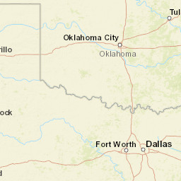
35.3435 3.31 |
-91.7013 0.7 |
4.4 931.37 |
22 0.089 |
15 75.525 |
87.3 | md 2.3 (13) 0.08 |
() |
() |
NM m i ke |
| Sta | Dist | EvAz | Phase | Datetime | Tres | Azim | AzRes | Slow | SRes | Def | SNR | Amp | Per | Mag1 | Mag2 |
|---|---|---|---|---|---|---|---|---|---|---|---|---|---|---|---|
| SEAR | 0.089 | 187.22 | P | 2025-03-25T10:57:15.23Z | -0.25 | ||||||||||
| X702 | 0.216 | 13.71 | P | 2025-03-25T10:57:17.54Z | -0.21 | ||||||||||
| X702 | 0.216 | 13.71 | S | 2025-03-25T10:57:20.97Z | 0.18 | ||||||||||
| WHAR | 0.484 | 263.83 | P | 2025-03-25T10:57:22.76Z | 0.16 | ||||||||||
| FCAR | 0.645 | 327.85 | P | 2025-03-25T10:57:25.5Z | -0.03 | ||||||||||
| FCAR | 0.645 | 327.85 | S | 2025-03-25T10:57:33.98Z | -0.3 | ||||||||||
| UALR | 0.774 | 223.05 | P | 2025-03-25T10:57:28.31Z | 0.41 | ||||||||||
| LCAR | 0.851 | 31.41 | P | 2025-03-25T10:57:29.49Z | 0.19 | ||||||||||
| HBAR | 0.878 | 75.8 | P | 2025-03-25T10:57:29.89Z | 0.06 | ||||||||||
| QUAR | 0.91 | 70.45 | P | 2025-03-25T10:57:31.6Z | 0.67 | ||||||||||
| X40A | 1.264 | 227.77 | P | 2025-03-25T10:57:36.62Z | 0.02 | ||||||||||
| X40A | 1.264 | 227.77 | S | 2025-03-25T10:57:53.16Z | -0.28 | ||||||||||
| U40A | 1.377 | 317.53 | P | 2025-03-25T10:57:38.67Z | 0.16 | ||||||||||
| COVE | 25.411 | 163.06 | P | 2025-03-25T10:57:21.87Z | 0 | ||||||||||
| COVE | 25.411 | 163.06 | S | 2025-03-25T10:57:27.79Z | -0.13 | ||||||||||
| BAT3 | 75.525 | 46.75 | P | 2025-03-25T10:57:23.84Z | -0.01 | ||||||||||
| BAT3 | 75.525 | 46.75 | S | 2025-03-25T10:57:31.36Z | 0 | ||||||||||
| Sta | Dist | EvAz | Phase | Datetime | Tres | Azim | AzRes | Slow | SRes | Def | SNR | Amp | Per | Mag1 | Mag2 |
| Centroid | Nodal Plan 1 | Nodal Plan 2 | Tensor | Moment Inf. | |||||||||||||||||
|---|---|---|---|---|---|---|---|---|---|---|---|---|---|---|---|---|---|---|---|---|---|
| Auth | Datetime | Lat | Lon | Depth | Mw | Strike | Dip | Rake | Strike | Dip | Rake | Mrr | Mtt | Mpp | Mrt | Mrp | Mtp | %DC | %ISO | %CLVD | |
| Auth | Datetime UTC | lat | lon | Depth | Mw | Strike | Dip | Rake | Strike | Dip | Rake | Mrr | Mtt | Mpp | Mrt | Mrp | Mtp | %DC | %ISO | %CLVD | |
