SeismicPortal
 is the European Infrastructure
 for seismological products in :
is the European Infrastructure 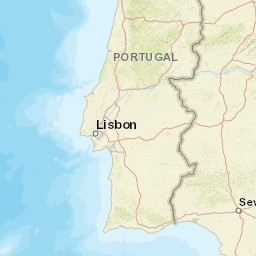


| Datetime (UTC) rmsOT_error |
Lat Smajor |
Lon Sminor |
D. (Km) AzErr |
Ndef mdist |
Nsta Mdist |
Gap | Mag1 (N) Err |
Mag2 (N) Err |
Mag3 (N) Err |
Author Quality |
|---|---|---|---|---|---|---|---|---|---|---|
| 2025-03-22T00:19:41.12Z 0.5+/- 1.03 |
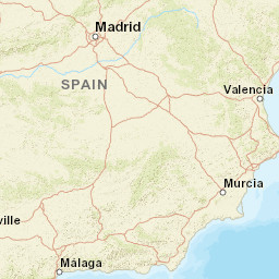
36.7187 7.8 |
-7.3424 3.9 |
18.4 1774.2 |
24 0.619 |
12 2.05 |
237.6 | ml 2.1 (4) 0.1 |
() |
() |
IGN m i ke |
| Sta | Dist | EvAz | Phase | Datetime | Tres | Azim | AzRes | Slow | SRes | Def | SNR | Amp | Per | Mag1 | Mag2 |
|---|---|---|---|---|---|---|---|---|---|---|---|---|---|---|---|
| ARNO | 0.619 | 52.01 | P | 2025-03-22T00:19:53.16Z | 0.5 | ||||||||||
| ARNO | 0.619 | 52.01 | S | 2025-03-22T00:20:00.551Z | -0.6 | ||||||||||
| PBDV | 0.704 | 318.16 | P | 2025-03-22T00:19:54.374Z | 0.4 | ||||||||||
| PBDV | 0.704 | 318.16 | S | 2025-03-22T00:20:03.212Z | -0.5 | ||||||||||
| PVAQ | 0.747 | 336.46 | P | 2025-03-22T00:19:54.655Z | -0.1 | ||||||||||
| PVAQ | 0.747 | 336.46 | S | 2025-03-22T00:20:04.766Z | -0.2 | ||||||||||
| EGRO | 0.822 | 352.18 | P | 2025-03-22T00:19:56.48Z | 0.5 | ||||||||||
| EGRO | 0.822 | 352.18 | S | 2025-03-22T00:20:07.465Z | 0.2 | 4.394e-7 | ML 1.9 | ||||||||
| PCVE | 1.069 | 328.84 | P | 2025-03-22T00:20:00.61Z | 0.2 | ||||||||||
| PCVE | 1.069 | 328.84 | S | 2025-03-22T00:20:13.565Z | -0.5 | ||||||||||
| EMIN | 1.175 | 26.85 | P | 2025-03-22T00:20:00.88Z | -0.5 | ||||||||||
| EMIN | 1.175 | 26.85 | S | 2025-03-22T00:20:16.234Z | -0.4 | 3.142e-7 | ML 2 | ||||||||
| MORF | 1.201 | 299.51 | P | 2025-03-22T00:20:00.242Z | -1.5 | ||||||||||
| MORF | 1.201 | 299.51 | S | 2025-03-22T00:20:17.388Z | 0.1 | ||||||||||
| PFVI | 1.259 | 289.61 | P | 2025-03-22T00:20:03.113Z | 0.6 | ||||||||||
| PFVI | 1.259 | 289.61 | S | 2025-03-22T00:20:18.41Z | -0.3 | ||||||||||
| MESJ | 1.32 | 328.24 | P | 2025-03-22T00:20:03.634Z | 0.2 | ||||||||||
| MESJ | 1.32 | 328.24 | S | 2025-03-22T00:20:20.332Z | 0.2 | ||||||||||
| PTEO | 1.378 | 307.19 | P | 2025-03-22T00:20:04.407Z | 0.2 | ||||||||||
| PTEO | 1.378 | 307.19 | S | 2025-03-22T00:20:21.778Z | 0.2 | ||||||||||
| ECAB | 2.044 | 47.95 | P | 2025-03-22T00:20:13.343Z | -0.1 | 1.889e-7 | ML 2.2 | ||||||||
| ECAB | 2.044 | 47.95 | S | 2025-03-22T00:20:37.662Z | -0.1 | ||||||||||
| EBAD | 2.05 | 7.21 | P | 2025-03-22T00:20:14.464Z | 0.9 | ||||||||||
| EBAD | 2.05 | 7.21 | S | 2025-03-22T00:20:38.447Z | 0.6 | 2.076e-7 | ML 2.2 | ||||||||
| Sta | Dist | EvAz | Phase | Datetime | Tres | Azim | AzRes | Slow | SRes | Def | SNR | Amp | Per | Mag1 | Mag2 |
| Centroid | Nodal Plan 1 | Nodal Plan 2 | Tensor | Moment Inf. | |||||||||||||||||
|---|---|---|---|---|---|---|---|---|---|---|---|---|---|---|---|---|---|---|---|---|---|
| Auth | Datetime | Lat | Lon | Depth | Mw | Strike | Dip | Rake | Strike | Dip | Rake | Mrr | Mtt | Mpp | Mrt | Mrp | Mtp | %DC | %ISO | %CLVD | |
| Auth | Datetime UTC | lat | lon | Depth | Mw | Strike | Dip | Rake | Strike | Dip | Rake | Mrr | Mtt | Mpp | Mrt | Mrp | Mtp | %DC | %ISO | %CLVD | |

