SeismicPortal
 is the European Infrastructure
 for seismological products in :
is the European Infrastructure 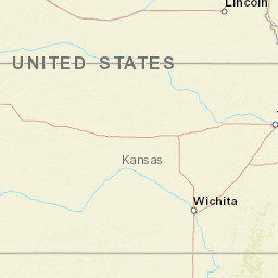


| Datetime (UTC) rmsOT_error |
Lat Smajor |
Lon Sminor |
D. (Km) AzErr |
Ndef mdist |
Nsta Mdist |
Gap | Mag1 (N) Err |
Mag2 (N) Err |
Mag3 (N) Err |
Author Quality |
|---|---|---|---|---|---|---|---|---|---|---|
| 2025-02-12T20:07:15.849999Z 0.19+/- |
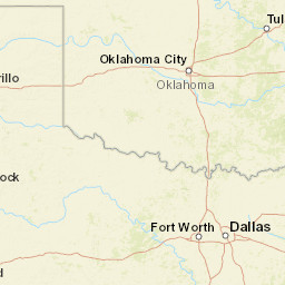
36.4082 |
-98.1422 |
6.4 0.4 |
70 0.083 |
35 0.98 |
75.3 | ml 2.1 (31) 0.23 |
() |
() |
OK m i ke |
| Sta | Dist | EvAz | Phase | Datetime | Tres | Azim | AzRes | Slow | SRes | Def | SNR | Amp | Per | Mag1 | Mag2 |
|---|---|---|---|---|---|---|---|---|---|---|---|---|---|---|---|
| AMES | 0.083 | 209.68 | P | 2025-02-12T20:07:18.109269Z | -0.09 | ||||||||||
| AMES | 0.083 | 209.68 | S | 2025-02-12T20:07:19.722945Z | -0.2 | ||||||||||
| CROK | 0.161 | 52.97 | P | 2025-02-12T20:07:19.637219Z | 0.07 | ML 2.449917844 | |||||||||
| CROK | 0.161 | 52.97 | S | 2025-02-12T20:07:22.260968Z | -0.02 | ||||||||||
| SC19 | 0.306 | 127.76 | P | 2025-02-12T20:07:22.356732Z | 0.08 | ML 2.184519644 | |||||||||
| SC19 | 0.306 | 127.76 | S | 2025-02-12T20:07:26.729791Z | -0.24 | ||||||||||
| FW06 | 0.306 | 290.27 | P | 2025-02-12T20:07:22.376493Z | 0.07 | ||||||||||
| FW06 | 0.306 | 290.27 | S | 2025-02-12T20:07:26.81646Z | -0.21 | ||||||||||
| FW05 | 0.378 | 279.53 | P | 2025-02-12T20:07:23.773322Z | 0.13 | ML 2.232132563 | |||||||||
| FW05 | 0.378 | 279.53 | S | 2025-02-12T20:07:28.986764Z | -0.34 | ||||||||||
| GORE | 0.408 | 22.55 | P | 2025-02-12T20:07:24.152259Z | 0.02 | ML 2.131975724 | |||||||||
| GORE | 0.408 | 22.55 | S | 2025-02-12T20:07:30.40802Z | -0.14 | ||||||||||
| HTCH | 0.42 | 201.63 | P | 2025-02-12T20:07:24.291615Z | -0.05 | ML 2.488133676 | |||||||||
| HTCH | 0.42 | 201.63 | S | 2025-02-12T20:07:30.49161Z | -0.04 | ||||||||||
| MRSH | 0.454 | 127.2 | P | 2025-02-12T20:07:24.93464Z | 0 | ML 2.379389362 | |||||||||
| MRSH | 0.454 | 127.2 | S | 2025-02-12T20:07:31.179016Z | -0.39 | ||||||||||
| FW04 | 0.461 | 294.14 | P | 2025-02-12T20:07:25.148068Z | 0.04 | ML 2.163346103 | |||||||||
| FW04 | 0.461 | 294.14 | S | 2025-02-12T20:07:31.867899Z | 0.01 | ||||||||||
| DOVR | 0.47 | 164.57 | P | 2025-02-12T20:07:25.18726Z | -0.03 | ML 1.731944868 | |||||||||
| DOVR | 0.47 | 164.57 | S | 2025-02-12T20:07:31.857748Z | -0.21 | ||||||||||
| FW10 | 0.474 | 282.05 | P | 2025-02-12T20:07:25.356616Z | 0.01 | ML 2.028974168 | |||||||||
| FW10 | 0.474 | 282.05 | S | 2025-02-12T20:07:32.223707Z | -0.06 | ||||||||||
| SC18 | 0.484 | 78.54 | P | 2025-02-12T20:07:26.100163Z | 0.4 | ML 1.793633245 | |||||||||
| SC18 | 0.484 | 78.54 | S | 2025-02-12T20:07:33.534787Z | 0.64 | ||||||||||
| GC02 | 0.498 | 27.05 | P | 2025-02-12T20:07:25.77863Z | 0.06 | ML 2.4352212 | |||||||||
| GC02 | 0.498 | 27.05 | S | 2025-02-12T20:07:32.693228Z | -0.23 | ||||||||||
| RNSP | 0.527 | 205.85 | P | 2025-02-12T20:07:26.52356Z | 0.26 | ML 2.01107907 | |||||||||
| RNSP | 0.527 | 205.85 | S | 2025-02-12T20:07:33.871611Z | 0 | ||||||||||
| FW07 | 0.533 | 274.69 | P | 2025-02-12T20:07:26.413712Z | 0.04 | ML 2.163575316 | |||||||||
| FW07 | 0.533 | 274.69 | S | 2025-02-12T20:07:33.976322Z | -0.06 | ||||||||||
| CVNG | 0.578 | 98.75 | P | 2025-02-12T20:07:27.162429Z | 0.01 | ML 2.100501596 | |||||||||
| CVNG | 0.578 | 98.75 | S | 2025-02-12T20:07:35.269722Z | -0.13 | ||||||||||
| CRES | 0.616 | 126.81 | P | 2025-02-12T20:07:27.860163Z | 0.06 | ML 2.208610783 | |||||||||
| CRES | 0.616 | 126.81 | S | 2025-02-12T20:07:36.214514Z | -0.31 | ||||||||||
| FW01 | 0.65 | 277.9 | P | 2025-02-12T20:07:28.427321Z | -0.01 | ML 1.879506217 | |||||||||
| FW01 | 0.65 | 277.9 | S | 2025-02-12T20:07:37.581819Z | -0.06 | ||||||||||
| CALT | 0.737 | 184.99 | P | 2025-02-12T20:07:30.459056Z | 0.46 | ML 1.96247499 | |||||||||
| CALT | 0.737 | 184.99 | S | 2025-02-12T20:07:40.597458Z | 0.27 | ||||||||||
| FW09 | 0.738 | 281.4 | P | 2025-02-12T20:07:30.93897Z | 0.05 | ML 1.866973918 | |||||||||
| FW09 | 0.738 | 281.4 | S | 2025-02-12T20:07:40.394965Z | -0.01 | ||||||||||
| PERY | 0.747 | 101.14 | P | 2025-02-12T20:07:30.152423Z | 0.05 | ML 1.731615571 | |||||||||
| PERY | 0.747 | 101.14 | S | 2025-02-12T20:07:40.31666Z | -0.18 | ||||||||||
| KS01 | 0.804 | 22.37 | P | 2025-02-12T20:07:31.38506Z | 0.22 | ML 1.924874367 | |||||||||
| KS01 | 0.804 | 22.37 | S | 2025-02-12T20:07:42.199964Z | -0.16 | ||||||||||
| KS13 | 0.806 | 41.28 | P | 2025-02-12T20:07:31.469954Z | 0.29 | ML 2.034795025 | |||||||||
| KS13 | 0.806 | 41.28 | S | 2025-02-12T20:07:42.138174Z | -0.23 | ||||||||||
| BLOK | 0.825 | 64.46 | P | 2025-02-12T20:07:31.625972Z | 0.12 | ML 2.325155044 | |||||||||
| BLOK | 0.825 | 64.46 | S | 2025-02-12T20:07:42.746132Z | -0.19 | ||||||||||
| KS08 | 0.829 | 9.49 | P | 2025-02-12T20:07:31.795859Z | 0.2 | ML 2.010087394 | |||||||||
| KS08 | 0.829 | 9.49 | S | 2025-02-12T20:07:43.43903Z | -0.05 | ||||||||||
| FW03 | 0.839 | 278.43 | P | 2025-02-12T20:07:32.16615Z | 0.15 | ||||||||||
| FW03 | 0.839 | 278.43 | S | 2025-02-12T20:07:43.625651Z | 0.06 | ||||||||||
| BLUF | 0.865 | 149.88 | P | 2025-02-12T20:07:32.236523Z | 0.01 | ML 1.747522887 | |||||||||
| BLUF | 0.865 | 149.88 | S | 2025-02-12T20:07:44.229947Z | 0.04 | ||||||||||
| PW18 | 0.896 | 97.95 | P | 2025-02-12T20:07:32.824519Z | 0.06 | ML 1.951132446 | |||||||||
| PW18 | 0.896 | 97.95 | S | 2025-02-12T20:07:44.938533Z | -0.17 | ||||||||||
| YUKO | 0.897 | 165.17 | P | 2025-02-12T20:07:33.39168Z | 0.21 | ML 2.525268784 | |||||||||
| YUKO | 0.897 | 165.17 | S | 2025-02-12T20:07:45.321132Z | 0.1 | ||||||||||
| PW19 | 0.906 | 79.46 | P | 2025-02-12T20:07:33.43712Z | 0.09 | ML 2.058837628 | |||||||||
| PW19 | 0.906 | 79.46 | S | 2025-02-12T20:07:45.868118Z | 0.44 | ||||||||||
| PW06 | 0.944 | 88.88 | P | 2025-02-12T20:07:33.849346Z | 0.23 | ML 1.812688977 | |||||||||
| PW06 | 0.944 | 88.88 | S | 2025-02-12T20:07:46.437487Z | -0.15 | ||||||||||
| PERK | 0.95 | 120.13 | P | 2025-02-12T20:07:33.266763Z | -0.46 | ML 2.112538705 | |||||||||
| PERK | 0.95 | 120.13 | S | 2025-02-12T20:07:46.558267Z | -0.22 | ||||||||||
| PW05 | 0.953 | 85.04 | P | 2025-02-12T20:07:33.920808Z | 0.14 | ML 1.825342971 | |||||||||
| PW05 | 0.953 | 85.04 | S | 2025-02-12T20:07:47.38598Z | 0.53 | ||||||||||
| ADOK | 0.98 | 140.13 | P | 2025-02-12T20:07:34.287169Z | 0.02 | ||||||||||
| ADOK | 0.98 | 140.13 | S | 2025-02-12T20:07:48.237478Z | 0.52 | ||||||||||
| Sta | Dist | EvAz | Phase | Datetime | Tres | Azim | AzRes | Slow | SRes | Def | SNR | Amp | Per | Mag1 | Mag2 |
| Centroid | Nodal Plan 1 | Nodal Plan 2 | Tensor | Moment Inf. | |||||||||||||||||
|---|---|---|---|---|---|---|---|---|---|---|---|---|---|---|---|---|---|---|---|---|---|
| Auth | Datetime | Lat | Lon | Depth | Mw | Strike | Dip | Rake | Strike | Dip | Rake | Mrr | Mtt | Mpp | Mrt | Mrp | Mtp | %DC | %ISO | %CLVD | |
| Auth | Datetime UTC | lat | lon | Depth | Mw | Strike | Dip | Rake | Strike | Dip | Rake | Mrr | Mtt | Mpp | Mrt | Mrp | Mtp | %DC | %ISO | %CLVD | |
