SeismicPortal
 is the European Infrastructure
 for seismological products in :
is the European Infrastructure 


| Datetime (UTC) rmsOT_error |
Lat Smajor |
Lon Sminor |
D. (Km) AzErr |
Ndef mdist |
Nsta Mdist |
Gap | Mag1 (N) Err |
Mag2 (N) Err |
Mag3 (N) Err |
Author Quality |
|---|---|---|---|---|---|---|---|---|---|---|
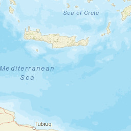
| 2025-02-08T04:05:44.6Z 0.94+/- 0.3 |
36.67 |
25.63 |
5 |
20 0.272 |
18 4.439 |
116.3 | ml 2.2 (5) 0.2 |
() |
() |
THE a i ke |
| Sta | Dist | EvAz | Phase | Datetime | Tres | Azim | AzRes | Slow | SRes | Def | SNR | Amp | Per | Mag1 | Mag2 |
|---|---|---|---|---|---|---|---|---|---|---|---|---|---|---|---|
| THR2 | 0.272 | 215.19 | P | 2025-02-08T04:05:51.3Z | 0.9 | ML 2.18 | |||||||||
| THR8 | 0.289 | 204.93 | P | 2025-02-08T04:05:49.2Z | -1.5 | ||||||||||
| SNT1 | 0.301 | 212.75 | P | 2025-02-08T04:05:51.6Z | 0.7 | ML 2.07 | |||||||||
| SFR2 | 0.311 | 209.86 | P | 2025-02-08T04:05:53.0Z | 1.9 | ||||||||||
| THR3 | 0.319 | 215.4 | P | 2025-02-08T04:05:50.9Z | -0.4 | ||||||||||
| THERA | 0.327 | 202.44 | P | 2025-02-08T04:05:51.0Z | -0.4 | ||||||||||
| SANT | 0.33 | 204.76 | P | 2025-02-08T04:05:51.0Z | -0.4 | ||||||||||
| ANAF | 0.333 | 159 | P | 2025-02-08T04:05:51.1Z | -0.4 | ||||||||||
| THR6 | 0.365 | 210.95 | P | 2025-02-08T04:05:51.8Z | -0.3 | ||||||||||
| APE | 0.411 | 347.98 | P | 2025-02-08T04:05:53.5Z | 0.5 | ||||||||||
| APE | 0.411 | 347.98 | P | 2025-02-08T04:05:53.5Z | 0.5 | ||||||||||
| NPS | 1.406 | 180.67 | P | 2025-02-08T04:06:11.8Z | 1.7 | ||||||||||
| SMG | 1.413 | 42.7 | P | 2025-02-08T04:06:11.5Z | 1.2 | ||||||||||
| ZKR | 1.623 | 162.76 | P | 2025-02-08T04:06:13.5Z | 0.1 | ||||||||||
| ATEI | 1.724 | 228.69 | P | 2025-02-08T04:06:18.1Z | 3.2 | ||||||||||
| PER1 | 2.038 | 311.67 | P | 2025-02-08T04:06:17.9Z | -1.6 | ||||||||||
| PER1 | 2.038 | 311.67 | P | 2025-02-08T04:06:19.5Z | -0.1 | ||||||||||
| ERTR | 2.27 | 320.35 | P | 2025-02-08T04:06:27.9Z | 5.2 | ||||||||||
| SIGR | 2.543 | 3.94 | P | 2025-02-08T04:06:26.0Z | -0.5 | ||||||||||
| ANTK | 2.916 | 306.26 | P | 2025-02-08T04:06:35.8Z | 4.2 | ||||||||||
| KOMA | 4.439 | 357.72 | P | 2025-02-08T04:06:52.3Z | -0.2 | ||||||||||
| Sta | Dist | EvAz | Phase | Datetime | Tres | Azim | AzRes | Slow | SRes | Def | SNR | Amp | Per | Mag1 | Mag2 |
| Centroid | Nodal Plan 1 | Nodal Plan 2 | Tensor | Moment Inf. | |||||||||||||||||
|---|---|---|---|---|---|---|---|---|---|---|---|---|---|---|---|---|---|---|---|---|---|
| Auth | Datetime | Lat | Lon | Depth | Mw | Strike | Dip | Rake | Strike | Dip | Rake | Mrr | Mtt | Mpp | Mrt | Mrp | Mtp | %DC | %ISO | %CLVD | |
| Auth | Datetime UTC | lat | lon | Depth | Mw | Strike | Dip | Rake | Strike | Dip | Rake | Mrr | Mtt | Mpp | Mrt | Mrp | Mtp | %DC | %ISO | %CLVD | |

