SeismicPortal
 is the European Infrastructure
 for seismological products in :
is the European Infrastructure 


| Datetime (UTC) rmsOT_error |
Lat Smajor |
Lon Sminor |
D. (Km) AzErr |
Ndef mdist |
Nsta Mdist |
Gap | Mag1 (N) Err |
Mag2 (N) Err |
Mag3 (N) Err |
Author Quality |
|---|---|---|---|---|---|---|---|---|---|---|
| 2025-02-06T15:06:07.8Z 0.35+/- 0.3 |
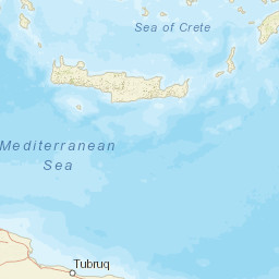
36.64 |
25.62 |
5 |
14 0.244 |
13 3.272 |
165.8 | ml 2.1 (4) 0.1 |
() |
() |
THE a i ke |
| Sta | Dist | EvAz | Phase | Datetime | Tres | Azim | AzRes | Slow | SRes | Def | SNR | Amp | Per | Mag1 | Mag2 |
|---|---|---|---|---|---|---|---|---|---|---|---|---|---|---|---|
| THR2 | 0.244 | 217.7 | P | 2025-02-06T15:06:13.1Z | 0.1 | ML 2.16 | |||||||||
| THR8 | 0.259 | 206.11 | P | 2025-02-06T15:06:13.0Z | -0.3 | ||||||||||
| THRA | 0.271 | 214.05 | P | 2025-02-06T15:06:16.3Z | 2.7 | ||||||||||
| SNT1 | 0.272 | 214.73 | P | 2025-02-06T15:06:13.4Z | -0.2 | ML 2.08 | |||||||||
| SFR2 | 0.281 | 211.48 | P | 2025-02-06T15:06:13.8Z | 0 | ||||||||||
| THERA | 0.296 | 203.21 | P | 2025-02-06T15:06:13.8Z | -0.2 | ||||||||||
| SANT | 0.299 | 205.75 | P | 2025-02-06T15:06:13.8Z | -0.3 | ML 2.26 | |||||||||
| ANAF | 0.309 | 155.61 | P | 2025-02-06T15:06:15.0Z | 0.8 | ||||||||||
| THR6 | 0.335 | 212.4 | P | 2025-02-06T15:06:14.8Z | 0 | ||||||||||
| THR9 | 0.353 | 217.04 | P | 2025-02-06T15:06:20.1Z | 5.1 | ||||||||||
| APE | 0.439 | 349.82 | P | 2025-02-06T15:06:16.5Z | -0.3 | ||||||||||
| APE | 0.439 | 349.82 | P | 2025-02-06T15:06:16.5Z | -0.3 | ||||||||||
| NAX1 | 0.501 | 336.87 | P | 2025-02-06T15:06:17.9Z | -0.1 | ||||||||||
| TNSA | 0.969 | 337.98 | P | 2025-02-06T15:06:26.6Z | 0.2 | ||||||||||
| VLY | 1.894 | 310.26 | P | 2025-02-06T15:06:43.7Z | 2.9 | ||||||||||
| MRTH | 1.995 | 318.41 | P | 2025-02-06T15:06:46.2Z | 4 | ||||||||||
| ERTR | 2.288 | 320.98 | P | 2025-02-06T15:06:51.6Z | 5.3 | ||||||||||
| VILL | 2.385 | 310.32 | P | 2025-02-06T15:06:53.2Z | 5.7 | ||||||||||
| KALE | 3.272 | 303.33 | P | 2025-02-06T15:07:00.6Z | 0.8 | ||||||||||
| Sta | Dist | EvAz | Phase | Datetime | Tres | Azim | AzRes | Slow | SRes | Def | SNR | Amp | Per | Mag1 | Mag2 |
| Centroid | Nodal Plan 1 | Nodal Plan 2 | Tensor | Moment Inf. | |||||||||||||||||
|---|---|---|---|---|---|---|---|---|---|---|---|---|---|---|---|---|---|---|---|---|---|
| Auth | Datetime | Lat | Lon | Depth | Mw | Strike | Dip | Rake | Strike | Dip | Rake | Mrr | Mtt | Mpp | Mrt | Mrp | Mtp | %DC | %ISO | %CLVD | |
| Auth | Datetime UTC | lat | lon | Depth | Mw | Strike | Dip | Rake | Strike | Dip | Rake | Mrr | Mtt | Mpp | Mrt | Mrp | Mtp | %DC | %ISO | %CLVD | |

