SeismicPortal
 is the European Infrastructure
 for seismological products in :
is the European Infrastructure 


| Datetime (UTC) rmsOT_error |
Lat Smajor |
Lon Sminor |
D. (Km) AzErr |
Ndef mdist |
Nsta Mdist |
Gap | Mag1 (N) Err |
Mag2 (N) Err |
Mag3 (N) Err |
Author Quality |
|---|---|---|---|---|---|---|---|---|---|---|
| 2025-01-13T14:09:17.944304Z 0.1+/- |
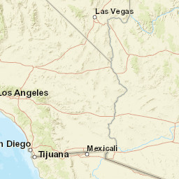
32.768 0.68 |
-100.666 0.57 |
7.3 157.17305386706841.4706535362744715 |
16 0.078 |
9 1.024 |
78.4 | ml 2.1 (18) 0.1 |
() |
() |
TX m i ke |
| Sta | Dist | EvAz | Phase | Datetime | Tres | Azim | AzRes | Slow | SRes | Def | SNR | Amp | Per | Mag1 | Mag2 |
|---|---|---|---|---|---|---|---|---|---|---|---|---|---|---|---|
| CF01 | 0.078 | 64.24 | P | 2025-01-13T14:09:19.921833Z | 0.023 | 175.20167289555218 | 0.008965658325796579 | ML 2.396471840645562 | |||||||
| CF01 | 0.078 | 64.24 | S | 2025-01-13T14:09:21.235614Z | -0.083 | ||||||||||
| SN09 | 0.113 | 213.03 | P | 2025-01-13T14:09:20.515409Z | 0.057 | 61.65491182331897 | 0.002991675287812599 | ML 2.146960906446946 | |||||||
| SN09 | 0.113 | 213.03 | S | 2025-01-13T14:09:22.311965Z | 0.027 | ||||||||||
| SN04 | 0.216 | 307.31 | P | 2025-01-13T14:09:22.304286Z | 0.037 | 26.48928659237997 | 0.0012891155845668808 | ML 2.1701405346314755 | |||||||
| SN04 | 0.216 | 307.31 | S | 2025-01-13T14:09:25.394438Z | -0.012 | ||||||||||
| SN02 | 0.227 | 294.96 | P | 2025-01-13T14:09:22.519524Z | 0.031 | 23.42098757700583 | 0.0006629187794688546 | ML 1.9151330293927833 | |||||||
| SN02 | 0.227 | 294.96 | S | 2025-01-13T14:09:25.754538Z | -0.035 | ||||||||||
| SN03 | 0.279 | 303.98 | P | 2025-01-13T14:09:23.417777Z | -0.029 | 24.46898036145602 | 0.0006931482931428938 | ML 2.0635002784466225 | |||||||
| SN03 | 0.279 | 303.98 | S | 2025-01-13T14:09:27.323228Z | -0.119 | ||||||||||
| SN10 | 0.284 | 350.14 | P | 2025-01-13T14:09:23.663035Z | 0.097 | 27.243854033432605 | 0.0006990553340083951 | ML 2.0815940612170776 | |||||||
| SN10 | 0.284 | 350.14 | S | 2025-01-13T14:09:27.675932Z | 0.029 | ||||||||||
| SN08 | 0.333 | 272.68 | P | 2025-01-13T14:09:24.362832Z | -0.076 | 11.460723886490396 | 0.00030729976392806845 | ML 1.8222904240104643 | |||||||
| SN08 | 0.333 | 272.68 | S | 2025-01-13T14:09:28.922445Z | -0.232 | ||||||||||
| SN07 | 0.374 | 329.52 | P | 2025-01-13T14:09:25.155703Z | -0.081 | 23.143337384992 | 0.00102691313242273 | ML 2.4248057120970623 | |||||||
| SN07 | 0.374 | 329.52 | S | 2025-01-13T14:09:30.206752Z | -0.326 | ||||||||||
| OP01 | 0.678 | 240.58 | P | 2025-01-13T14:09:30.621656Z | -0.361 | 1.9170047071242062 | 0.0003487414682768343 | ML 2.35110651762245 | |||||||
| OP01 | 0.678 | 240.58 | S | 2025-01-13T14:09:39.444059Z | -1.007 | ||||||||||
| MO01 | 0.701 | 248.82 | P | 2025-01-13T14:09:31.12392Z | -0.402 | 6.902517101272748 | 0.0002870708414739243 | ML 2.2888499496769064 | |||||||
| MO01 | 0.701 | 248.82 | S | 2025-01-13T14:09:40.287226Z | -0.908 | ||||||||||
| APMT | 0.719 | 39.29 | P | 2025-01-13T14:09:31.485388Z | -0.32 | 5.251152503719833 | 0.00016135138011395602 | ML 2.058276612951073 | |||||||
| APMT | 0.719 | 39.29 | S | 2025-01-13T14:09:41.644519Z | -0.226 | ||||||||||
| POST | 0.763 | 293.16 | P | 2025-01-13T14:09:32.344353Z | -0.256 | 4.014095326030354 | 0.00010868926025089434 | ML 1.924917130681951 | |||||||
| POST | 0.763 | 293.16 | S | 2025-01-13T14:09:42.228983Z | -1.015 | ||||||||||
| ABTX | 0.875 | 99.17 | P | 2025-01-13T14:09:34.446754Z | -0.266 | 8.988759308933504 | 0.00018365823009919223 | ML 2.245235895227345 | |||||||
| ABTX | 0.875 | 99.17 | S | 2025-01-13T14:09:45.901483Z | -0.988 | ||||||||||
| MB03 | 1.024 | 177.57 | P | 2025-01-13T14:09:37.79079Z | -0.577 | 6.06257512766184 | 0.00008903273773158132 | ML 2.0893652037368295 | |||||||
| MB03 | 1.024 | 177.57 | S | 2025-01-13T14:09:50.590313Z | -1.38 | ||||||||||
| Sta | Dist | EvAz | Phase | Datetime | Tres | Azim | AzRes | Slow | SRes | Def | SNR | Amp | Per | Mag1 | Mag2 |
| Centroid | Nodal Plan 1 | Nodal Plan 2 | Tensor | Moment Inf. | |||||||||||||||||
|---|---|---|---|---|---|---|---|---|---|---|---|---|---|---|---|---|---|---|---|---|---|
| Auth | Datetime | Lat | Lon | Depth | Mw | Strike | Dip | Rake | Strike | Dip | Rake | Mrr | Mtt | Mpp | Mrt | Mrp | Mtp | %DC | %ISO | %CLVD | |
| Auth | Datetime UTC | lat | lon | Depth | Mw | Strike | Dip | Rake | Strike | Dip | Rake | Mrr | Mtt | Mpp | Mrt | Mrp | Mtp | %DC | %ISO | %CLVD | |

