SeismicPortal
 is the European Infrastructure
 for seismological products in :
is the European Infrastructure 


| Datetime (UTC) rmsOT_error |
Lat Smajor |
Lon Sminor |
D. (Km) AzErr |
Ndef mdist |
Nsta Mdist |
Gap | Mag1 (N) Err |
Mag2 (N) Err |
Mag3 (N) Err |
Author Quality |
|---|---|---|---|---|---|---|---|---|---|---|
| 2024-12-12T15:43:39.19Z 0.08+/- |
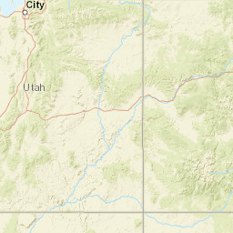
40.3188 5.95 |
-124.4712 1.27 |
12.5 2680.6000000240000001 |
16 0.103 |
16 88.029 |
246.1 | md 2.7 (17) 0.11 |
() |
() |
NC a i ke |
| Sta | Dist | EvAz | Phase | Datetime | Tres | Azim | AzRes | Slow | SRes | Def | SNR | Amp | Per | Mag1 | Mag2 |
|---|---|---|---|---|---|---|---|---|---|---|---|---|---|---|---|
| PETL | 0.103 | 107.4 | P | 2024-12-12T15:43:42.61Z | 0.03 | ||||||||||
| WLKR | 0.122 | 68.81 | P | 2024-12-12T15:43:42.89Z | 0.02 | ||||||||||
| B046 | 0.143 | 88.67 | P | 2024-12-12T15:43:43.4Z | -0.03 | ||||||||||
| B047 | 0.239 | 106.34 | P | 2024-12-12T15:43:44.78Z | -0.02 | ||||||||||
| KSM | 0.261 | 120.14 | P | 2024-12-12T15:43:45.11Z | -0.02 | ||||||||||
| RBOW | 0.276 | 86.53 | P | 2024-12-12T15:43:45.8Z | 0.2 | ||||||||||
| KMPB | 0.285 | 69.73 | P | 2024-12-12T15:43:45.83Z | 0.14 | ||||||||||
| KPR | 0.332 | 107.25 | P | 2024-12-12T15:43:46.6Z | -0.06 | ||||||||||
| GHOP | 0.377 | 91.73 | P | 2024-12-12T15:43:47.66Z | 0.15 | ||||||||||
| B045 | 0.381 | 71.98 | P | 2024-12-12T15:43:47.33Z | -0.13 | ||||||||||
| PRDS | 0.39 | 122.97 | P | 2024-12-12T15:43:47.1Z | -0.64 | ||||||||||
| KBU | 0.478 | 98.6 | P | 2024-12-12T15:43:49.13Z | -0.24 | ||||||||||
| BRIC | 0.486 | 114.98 | P | 2024-12-12T15:43:49.6Z | -0.45 | ||||||||||
| SPRL | 0.561 | 121.68 | P | 2024-12-12T15:43:50.15Z | -0.68 | ||||||||||
| KMR | 0.595 | 101.05 | P | 2024-12-12T15:43:51.65Z | 0.06 | ||||||||||
| JEWT | 0.694 | 111.31 | P | 2024-12-12T15:43:53.33Z | 0.54 | ||||||||||
| LBK | 1.57 | 60.28 | P | 2024-12-12T15:44:03.68Z | -1.51 | ||||||||||
| AL6 | 1.962 | 140.11 | P | 2024-12-12T15:44:15.37Z | 4.74 | ||||||||||
| YUBA | 3.183 | 106.65 | P | 2024-12-12T15:44:33.5Z | 5.65 | ||||||||||
| JBR | 3.683 | 147.75 | P | 2024-12-12T15:44:40.31Z | 5.43 | ||||||||||
| MOD | 3.751 | 134.84 | P | 2024-12-12T15:44:38.11Z | 2.27 | ||||||||||
| THOM | 83.865 | 33.83 | P | 2024-12-12T15:43:59.8Z | -2.38 | ||||||||||
| AF06 | 88.029 | 72.1 | P | 2024-12-12T15:43:45.3Z | -0.68 | ||||||||||
| Sta | Dist | EvAz | Phase | Datetime | Tres | Azim | AzRes | Slow | SRes | Def | SNR | Amp | Per | Mag1 | Mag2 |
| Centroid | Nodal Plan 1 | Nodal Plan 2 | Tensor | Moment Inf. | |||||||||||||||||
|---|---|---|---|---|---|---|---|---|---|---|---|---|---|---|---|---|---|---|---|---|---|
| Auth | Datetime | Lat | Lon | Depth | Mw | Strike | Dip | Rake | Strike | Dip | Rake | Mrr | Mtt | Mpp | Mrt | Mrp | Mtp | %DC | %ISO | %CLVD | |
| Auth | Datetime UTC | lat | lon | Depth | Mw | Strike | Dip | Rake | Strike | Dip | Rake | Mrr | Mtt | Mpp | Mrt | Mrp | Mtp | %DC | %ISO | %CLVD | |

