SeismicPortal
 is the European Infrastructure
 for seismological products in :
is the European Infrastructure 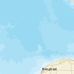
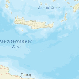


| Datetime (UTC) rmsOT_error |
Lat Smajor |
Lon Sminor |
D. (Km) AzErr |
Ndef mdist |
Nsta Mdist |
Gap | Mag1 (N) Err |
Mag2 (N) Err |
Mag3 (N) Err |
Author Quality |
|---|---|---|---|---|---|---|---|---|---|---|
| 2024-12-11T12:09:59.6Z 0.45+/- |
36.2 |
23.79 |
3 12 |
18 0.517 |
11 1.372 |
85 | ml 2.3 (8) 0.22 |
() |
() |
THE m i ke |
| Sta | Dist | EvAz | Phase | Datetime | Tres | Azim | AzRes | Slow | SRes | Def | SNR | Amp | Per | Mag1 | Mag2 |
|---|---|---|---|---|---|---|---|---|---|---|---|---|---|---|---|
| ANKY | 0.517 | 230.17 | P | 2024-12-11T12:10:09.8Z | 0.4 | ||||||||||
| ANKY | 0.517 | 230.17 | S | 2024-12-11T12:10:16.3Z | -0.8 | ML 2.16 | |||||||||
| KTHA | 0.591 | 275.7 | P | 2024-12-11T12:10:11.5Z | 0.7 | ||||||||||
| KTHA | 0.591 | 275.7 | S | 2024-12-11T12:10:19.0Z | -0.5 | ML 2.03 | |||||||||
| MHLO | 0.695 | 45.08 | P | 2024-12-11T12:10:12.8Z | 0.2 | ||||||||||
| MHLO | 0.695 | 45.08 | S | 2024-12-11T12:10:22.5Z | -0.2 | ML 2.58 | |||||||||
| CH03 | 0.703 | 161.02 | P | 2024-12-11T12:10:13.4Z | 0.5 | ||||||||||
| CH03 | 0.703 | 161.02 | S | 2024-12-11T12:10:20.9Z | -2.4 | ||||||||||
| IMMV | 0.754 | 168.06 | P | 2024-12-11T12:10:13.6Z | -0.3 | ||||||||||
| IMMV | 0.754 | 168.06 | S | 2024-12-11T12:10:22.7Z | -2.3 | ML 2.53 | |||||||||
| VLI | 0.854 | 307.51 | P | 2024-12-11T12:10:16.2Z | 0.6 | ||||||||||
| VLI | 0.854 | 307.51 | S | 2024-12-11T12:10:27.8Z | -0.2 | ML 2.1 | |||||||||
| VAM | 0.859 | 157.04 | P | 2024-12-11T12:10:15.7Z | -0.1 | ||||||||||
| VAM | 0.859 | 157.04 | S | 2024-12-11T12:10:25.6Z | -2.9 | ML 2.49 | |||||||||
| GR32 | 1.002 | 320.09 | P | 2024-12-11T12:10:18.5Z | 0.1 | ||||||||||
| GR32 | 1.002 | 320.09 | S | 2024-12-11T12:10:31.6Z | -1.3 | ||||||||||
| IDI | 1.276 | 135.16 | P | 2024-12-11T12:10:22.8Z | -0.7 | ||||||||||
| IDI | 1.276 | 135.16 | S | 2024-12-11T12:10:37.4Z | -4.7 | ML 2.23 | |||||||||
| THERA | 1.372 | 82.52 | P | 2024-12-11T12:10:25.6Z | 0.8 | ||||||||||
| THERA | 1.372 | 82.52 | S | 2024-12-11T12:10:44.0Z | -0.3 | ML 2.09 | |||||||||
| Sta | Dist | EvAz | Phase | Datetime | Tres | Azim | AzRes | Slow | SRes | Def | SNR | Amp | Per | Mag1 | Mag2 |
| Centroid | Nodal Plan 1 | Nodal Plan 2 | Tensor | Moment Inf. | |||||||||||||||||
|---|---|---|---|---|---|---|---|---|---|---|---|---|---|---|---|---|---|---|---|---|---|
| Auth | Datetime | Lat | Lon | Depth | Mw | Strike | Dip | Rake | Strike | Dip | Rake | Mrr | Mtt | Mpp | Mrt | Mrp | Mtp | %DC | %ISO | %CLVD | |
| Auth | Datetime UTC | lat | lon | Depth | Mw | Strike | Dip | Rake | Strike | Dip | Rake | Mrr | Mtt | Mpp | Mrt | Mrp | Mtp | %DC | %ISO | %CLVD | |

