SeismicPortal
 is the European Infrastructure
 for seismological products in :
is the European Infrastructure 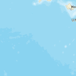


| Datetime (UTC) rmsOT_error |
Lat Smajor |
Lon Sminor |
D. (Km) AzErr |
Ndef mdist |
Nsta Mdist |
Gap | Mag1 (N) Err |
Mag2 (N) Err |
Mag3 (N) Err |
Author Quality |
|---|---|---|---|---|---|---|---|---|---|---|
| 2024-07-14T05:44:26.93Z 0.1+/- |
19.4003 0.79 |
-155.2853 0.34 |
0.1 3000.31999999300000004 |
15 0.012 |
9 0.116 |
111.8 | md 2 (7) 0.25 |
() |
() |
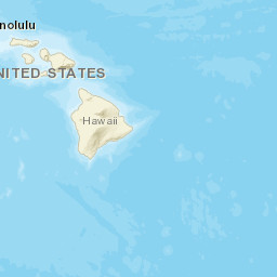
HV a i ke |
| Sta | Dist | EvAz | Phase | Datetime | Tres | Azim | AzRes | Slow | SRes | Def | SNR | Amp | Per | Mag1 | Mag2 |
|---|---|---|---|---|---|---|---|---|---|---|---|---|---|---|---|
| RIMD | 0.012 | 116.36 | P | 2024-07-14T05:44:27.57Z | -0.08 | ||||||||||
| RIMD | 0.012 | 116.36 | S | 2024-07-14T05:44:28.97Z | 0.78 | ||||||||||
| SDH | 0.013 | 218.5 | P | 2024-07-14T05:44:27.59Z | -0.09 | ||||||||||
| SDH | 0.013 | 218.5 | S | 2024-07-14T05:44:28.39Z | 0.15 | ||||||||||
| OTLD | 0.014 | 166.63 | P | 2024-07-14T05:44:27.69Z | -0.04 | ||||||||||
| OTLD | 0.014 | 166.63 | S | 2024-07-14T05:44:28.2Z | -0.13 | ||||||||||
| WRM | 0.015 | 295.61 | P | 2024-07-14T05:44:27.75Z | 0.02 | ||||||||||
| WRM | 0.015 | 295.61 | S | 2024-07-14T05:44:28.51Z | 0.18 | ||||||||||
| KKO | 0.018 | 97.24 | S | 2024-07-14T05:44:28.76Z | 0.11 | ||||||||||
| UWE | 0.021 | 345.43 | P | 2024-07-14T05:44:28.4Z | 0.02 | ||||||||||
| UWE | 0.021 | 345.43 | S | 2024-07-14T05:44:28.73Z | -0.11 | ||||||||||
| AHUD | 0.035 | 143.19 | P | 2024-07-14T05:44:28.39Z | -0.12 | ||||||||||
| AHUD | 0.035 | 143.19 | S | 2024-07-14T05:44:29.81Z | 0.11 | ||||||||||
| AHUD | 0.035 | 143.19 | S | 2024-07-14T05:44:29.83Z | 0.13 | ||||||||||
| CPKD | 0.038 | 255.73 | P | 2024-07-14T05:44:28.39Z | -0.02 | ||||||||||
| DESD | 0.116 | 234.84 | P | 2024-07-14T05:44:30.3Z | -0.09 | ||||||||||
| Sta | Dist | EvAz | Phase | Datetime | Tres | Azim | AzRes | Slow | SRes | Def | SNR | Amp | Per | Mag1 | Mag2 |
| Centroid | Nodal Plan 1 | Nodal Plan 2 | Tensor | Moment Inf. | |||||||||||||||||
|---|---|---|---|---|---|---|---|---|---|---|---|---|---|---|---|---|---|---|---|---|---|
| Auth | Datetime | Lat | Lon | Depth | Mw | Strike | Dip | Rake | Strike | Dip | Rake | Mrr | Mtt | Mpp | Mrt | Mrp | Mtp | %DC | %ISO | %CLVD | |
| Auth | Datetime UTC | lat | lon | Depth | Mw | Strike | Dip | Rake | Strike | Dip | Rake | Mrr | Mtt | Mpp | Mrt | Mrp | Mtp | %DC | %ISO | %CLVD | |


