SeismicPortal
 is the European Infrastructure
 for seismological products in :
is the European Infrastructure 


| Datetime (UTC) rmsOT_error |
Lat Smajor |
Lon Sminor |
D. (Km) AzErr |
Ndef mdist |
Nsta Mdist |
Gap | Mag1 (N) Err |
Mag2 (N) Err |
Mag3 (N) Err |
Author Quality |
|---|---|---|---|---|---|---|---|---|---|---|
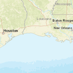
| 2024-04-17T00:38:38.935507Z 0.1+/- |
29.091 1.34 |
-97.812 0.59 |
3.6 124.563305109678451.4430207163771707 |
13 0.036 |
12 0.856 |
86.3 | ml 2 (7) 0.2 |
() |
() |
TX m i ke |
| Sta | Dist | EvAz | Phase | Datetime | Tres | Azim | AzRes | Slow | SRes | Def | SNR | Amp | Per | Mag1 | Mag2 |
|---|---|---|---|---|---|---|---|---|---|---|---|---|---|---|---|
| EF53 | 0.036 | 169.46 | P | 2024-04-17T00:38:38.953354Z | -0.946 | 122.99113853123276 | 0.03619506271864246 | ML 2.342491806817505 | |||||||
| EF53 | 0.036 | 169.46 | S | 2024-04-17T00:38:40.611928Z | 0.013 | ||||||||||
| EF04 | 0.12 | 9.21 | P | 2024-04-17T00:38:41.327389Z | -0.014 | 25.407230313565197 | 0.0013450404195024133 | ML 1.7578912221136151 | |||||||
| EF04 | 0.12 | 9.21 | S | 2024-04-17T00:38:44.817487Z | 1.729 | ||||||||||
| EF73 | 0.131 | 214.47 | P | 2024-04-17T00:38:40.492244Z | -1.043 | 36.784434245976534 | 0.0023126892771941 | ML 2.0635620934912353 | |||||||
| EF73 | 0.131 | 214.47 | S | 2024-04-17T00:38:43.375207Z | -0.048 | ||||||||||
| EF61 | 0.154 | 282.88 | P | 2024-04-17T00:38:41.415467Z | -0.54 | ||||||||||
| EF61 | 0.154 | 282.88 | S | 2024-04-17T00:38:44.916575Z | 0.768 | ||||||||||
| EF54 | 0.173 | 67.29 | P | 2024-04-17T00:38:42.296249Z | -0.008 | 8.84463366466899 | 0.0004492556513180914 | ML 1.543159286425152 | |||||||
| EF54 | 0.173 | 67.29 | S | 2024-04-17T00:38:46.546022Z | 1.796 | ||||||||||
| 735B | 0.235 | 179.15 | P | 2024-04-17T00:38:42.521744Z | -0.978 | ||||||||||
| 735B | 0.235 | 179.15 | S | 2024-04-17T00:38:47.255029Z | 0.441 | ||||||||||
| EF05 | 0.277 | 111.28 | P | 2024-04-17T00:38:43.989649Z | -0.281 | 6.127284142028661 | 0.0004511383843805651 | ML 1.8555961686906937 | |||||||
| EF62 | 0.295 | 22.09 | P | 2024-04-17T00:38:44.58103Z | -0.061 | 12.21276065520524 | 0.0003928778940554728 | ML 1.8411256216018586 | |||||||
| EF72 | 0.3 | 139.99 | P | 2024-04-17T00:38:44.20094Z | -0.532 | ||||||||||
| EF75 | 0.397 | 182.54 | P | 2024-04-17T00:38:46.68642Z | 0.095 | 16.76630593872349 | 0.0007565756936393428 | ML 2.3247255106920344 | |||||||
| EF52 | 0.421 | 234.28 | P | 2024-04-17T00:38:47.184988Z | 0.148 | 5.261472928901084 | 0.0002680655426332558 | ML 1.9124217578138407 | |||||||
| FLRS | 0.499 | 274.38 | P | 2024-04-17T00:38:48.33118Z | -0.471 | ||||||||||
| EF71 | 0.504 | 203.85 | P | 2024-04-17T00:38:48.150788Z | -0.494 | ||||||||||
| EF59 | 0.55 | 255.36 | P | 2024-04-17T00:38:49.422983Z | -0.061 | 10.49305047334223 | 0.0005835005358403092 | ML 2.42972656625313 | |||||||
| EF63 | 0.571 | 32.12 | P | 2024-04-17T00:38:50.165097Z | 0.248 | 6.83667310087664 | 0.0002750813797902909 | ML 2.1305801992864737 | |||||||
| EF02 | 0.704 | 243.7 | P | 2024-04-17T00:38:52.470951Z | 0.026 | 4.119826832580152 | 0.00019177250532832171 | ML 2.1154169701577503 | |||||||
| EF77 | 0.856 | 189.44 | P | 2024-04-17T00:38:56.393553Z | 0.981 | ||||||||||
| Sta | Dist | EvAz | Phase | Datetime | Tres | Azim | AzRes | Slow | SRes | Def | SNR | Amp | Per | Mag1 | Mag2 |
| Centroid | Nodal Plan 1 | Nodal Plan 2 | Tensor | Moment Inf. | |||||||||||||||||
|---|---|---|---|---|---|---|---|---|---|---|---|---|---|---|---|---|---|---|---|---|---|
| Auth | Datetime | Lat | Lon | Depth | Mw | Strike | Dip | Rake | Strike | Dip | Rake | Mrr | Mtt | Mpp | Mrt | Mrp | Mtp | %DC | %ISO | %CLVD | |
| Auth | Datetime UTC | lat | lon | Depth | Mw | Strike | Dip | Rake | Strike | Dip | Rake | Mrr | Mtt | Mpp | Mrt | Mrp | Mtp | %DC | %ISO | %CLVD | |

