SeismicPortal
 is the European Infrastructure
 for seismological products in :
is the European Infrastructure 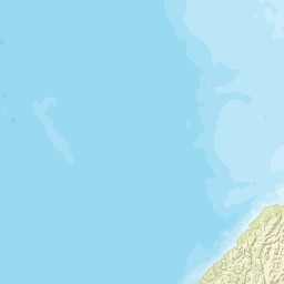


| Datetime (UTC) rmsOT_error |
Lat Smajor |
Lon Sminor |
D. (Km) AzErr |
Ndef mdist |
Nsta Mdist |
Gap | Mag1 (N) Err |
Mag2 (N) Err |
Mag3 (N) Err |
Author Quality |
|---|---|---|---|---|---|---|---|---|---|---|
| 2024-03-04T02:36:38.342276Z 0.61+/- |
-45.3381 31.25 |
170.4155 18.61 |
5.5 75.8341677136.439786999999995 |
10 0.336 |
10 1.685 |
137.9 | m 3.3 (1) |
() |
() |
GNS a i ke |
| Sta | Dist | EvAz | Phase | Datetime | Tres | Azim | AzRes | Slow | SRes | Def | SNR | Amp | Per | Mag1 | Mag2 |
|---|---|---|---|---|---|---|---|---|---|---|---|---|---|---|---|
| ODZ | 0.336 | 28.98 | P | 2024-03-04T02:36:46.31Z | -0.223 | ML 1.600247998 | |||||||||
| OPZ | 0.56 | 166.86 | P | 2024-03-04T02:36:51.59313Z | 0.303 | ML 2.498787399 | |||||||||
| EAZ | 0.789 | 277.41 | P | 2024-03-04T02:36:54.89313Z | 0.099 | ML 2.376741539 | |||||||||
| TUZ | 0.825 | 221.49 | P | 2024-03-04T02:36:55.1Z | -0.155 | ML 2.419566334 | |||||||||
| LBZ | 0.966 | 350.11 | P | 2024-03-04T02:36:58.22313Z | 0.494 | ML 2.583162514 | |||||||||
| CVZ | 1.043 | 23.95 | P | 2024-03-04T02:37:00.11313Z | 1.226 | ML 2.943570027 | |||||||||
| WKZ | 1.114 | 296.81 | P | 2024-03-04T02:37:01.18313Z | 0.772 | ML 2.764138241 | |||||||||
| SYZ | 1.493 | 216.15 | P | 2024-03-04T02:37:06.24Z | 0.178 | ML 2.933331023 | |||||||||
| MLZ | 1.619 | 268.16 | P | 2024-03-04T02:37:09.89Z | 1.958 | ||||||||||
| RPZ | 1.685 | 15.94 | P | 2024-03-04T02:37:09.39Z | 0.087 | ML 3.318630968 | |||||||||
| Sta | Dist | EvAz | Phase | Datetime | Tres | Azim | AzRes | Slow | SRes | Def | SNR | Amp | Per | Mag1 | Mag2 |
| Centroid | Nodal Plan 1 | Nodal Plan 2 | Tensor | Moment Inf. | |||||||||||||||||
|---|---|---|---|---|---|---|---|---|---|---|---|---|---|---|---|---|---|---|---|---|---|
| Auth | Datetime | Lat | Lon | Depth | Mw | Strike | Dip | Rake | Strike | Dip | Rake | Mrr | Mtt | Mpp | Mrt | Mrp | Mtp | %DC | %ISO | %CLVD | |
| Auth | Datetime UTC | lat | lon | Depth | Mw | Strike | Dip | Rake | Strike | Dip | Rake | Mrr | Mtt | Mpp | Mrt | Mrp | Mtp | %DC | %ISO | %CLVD | |

