

AFAD
| Datetime (UTC) rmsOT_error |
Lat Smajor |
Lon Sminor |
D. (Km) AzErr |
Ndef mdist |
Nsta Mdist |
Gap | Mag1 (N) Err |
Mag2 (N) Err |
Mag3 (N) Err |
Author Quality |
|---|---|---|---|---|---|---|---|---|---|---|
| 2025-02-15T10:08:12.0Z 0.33+/- |
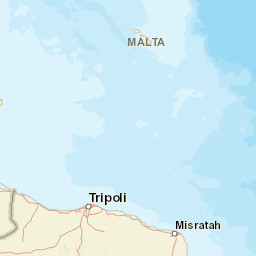
36.2567 |
28.9586 |
6.8 |
17 0.281 |
9 1.207 |
206.4 | ml 1.7 () |
() |
() |
AFAD m i ke |
| Sta | Dist | EvAz | Phase | Datetime | Tres | Azim | AzRes | Slow | SRes | Def | SNR | Amp | Per | Mag1 | Mag2 |
|---|---|---|---|---|---|---|---|---|---|---|---|---|---|---|---|
| IZZE | 0.281 | 50.09 | S | 2025-02-15T10:08:11.5Z | -6.97 | ||||||||||
| IZZE | 0.281 | 50.09 | P | 2025-02-15T10:08:11.5Z | -7.74 | ||||||||||
| FETY | 0.391 | 14.95 | S | 2025-02-15T10:08:20.1Z | 0.28 | ||||||||||
| FETY | 0.391 | 14.95 | P | 2025-02-15T10:08:20.1Z | -0.1 | ||||||||||
| AKAS | 0.523 | 92.4 | S | 2025-02-15T10:08:22.75Z | 2.79 | ||||||||||
| AKAS | 0.523 | 92.4 | P | 2025-02-15T10:08:22.75Z | 0.27 | ||||||||||
| SABU | 0.566 | 0.81 | S | 2025-02-15T10:08:23.11Z | 1.67 | ||||||||||
| SABU | 0.566 | 0.81 | P | 2025-02-15T10:08:23.11Z | -0.22 | ||||||||||
| DALY | 0.61 | 336.3 | S | 2025-02-15T10:08:23.63Z | 0.54 | ||||||||||
| DALY | 0.61 | 336.3 | P | 2025-02-15T10:08:23.63Z | -0.35 | ||||||||||
| KNIK | 0.768 | 39.91 | S | 2025-02-15T10:08:26.54Z | 0.17 | ||||||||||
| KNIK | 0.768 | 39.91 | P | 2025-02-15T10:08:26.54Z | -0.41 | ||||||||||
| TURN | 0.774 | 312.15 | S | 2025-02-15T10:08:27.22Z | 0.01 | ||||||||||
| TURN | 0.774 | 312.15 | P | 2025-02-15T10:08:27.22Z | 0 | ||||||||||
| TASL | 0.789 | 298.81 | S | 2025-02-15T10:08:28.1Z | -0.21 | ||||||||||
| TASL | 0.789 | 298.81 | P | 2025-02-15T10:08:28.1Z | 0.46 | ||||||||||
| GOLH | 1.09 | 26.07 | S | 2025-02-15T10:08:35.49Z | 3.38 | ||||||||||
| GOLH | 1.09 | 26.07 | P | 2025-02-15T10:08:35.49Z | 2.47 | ||||||||||
| TAVA | 1.207 | 358.28 | S | 2025-02-15T10:08:34.55Z | -0.79 | ||||||||||
| TAVA | 1.207 | 358.28 | P | 2025-02-15T10:08:34.55Z | -0.44 | ||||||||||
| Sta | Dist | EvAz | Phase | Datetime | Tres | Azim | AzRes | Slow | SRes | Def | SNR | Amp | Per | Mag1 | Mag2 |
| Centroid | Nodal Plan 1 | Nodal Plan 2 | Tensor | Moment Inf. | |||||||||||||||||
|---|---|---|---|---|---|---|---|---|---|---|---|---|---|---|---|---|---|---|---|---|---|
| Auth | Datetime | Lat | Lon | Depth | Mw | Strike | Dip | Rake | Strike | Dip | Rake | Mrr | Mtt | Mpp | Mrt | Mrp | Mtp | %DC | %ISO | %CLVD | |
| Auth | Datetime UTC | lat | lon | Depth | Mw | Strike | Dip | Rake | Strike | Dip | Rake | Mrr | Mtt | Mpp | Mrt | Mrp | Mtp | %DC | %ISO | %CLVD | |

